August 19, 2012

Prusik Peak - West Ridge (P in a D)

Fed up with the prospects of trying to obtain a permit to camp in the Enchantments area of the Alpine Lakes Wilderness, we decided to climb the West Ridge of Prusik Peak in a day (or P in a D).  In this instance, "we" refers to Kris, Evan, Ava, and me.  Prusik is typically climbed in two days as the approach is about 10 miles and gains close to 5,000 ft in elevation.

After spending Friday night at the Stuart Lake trailhead, we left at 4am.  We made it to Colchuck Lake in two hours.  Two hours after that, we arrived at the top of Aasgard Pass.  Aasgard gets a bad rap because the trail gains 2,200 feet of elevation in 0.8 miles, but it really didn't seem that bad.  The trail is easy to follow and in good condition considering the terrain it ascends.

Beautiful views in the Alpine Lakes Wilderness

Seems I've been seeing a lot of these guys lately
Once over Aasgard Pass, you enter the upper Enchantment Basin, which is much less steep than the other side of the pass.  We descended about 700 feet on the other side of the pass before climbing back up to Prusik Pass and the start of the technical climbing.

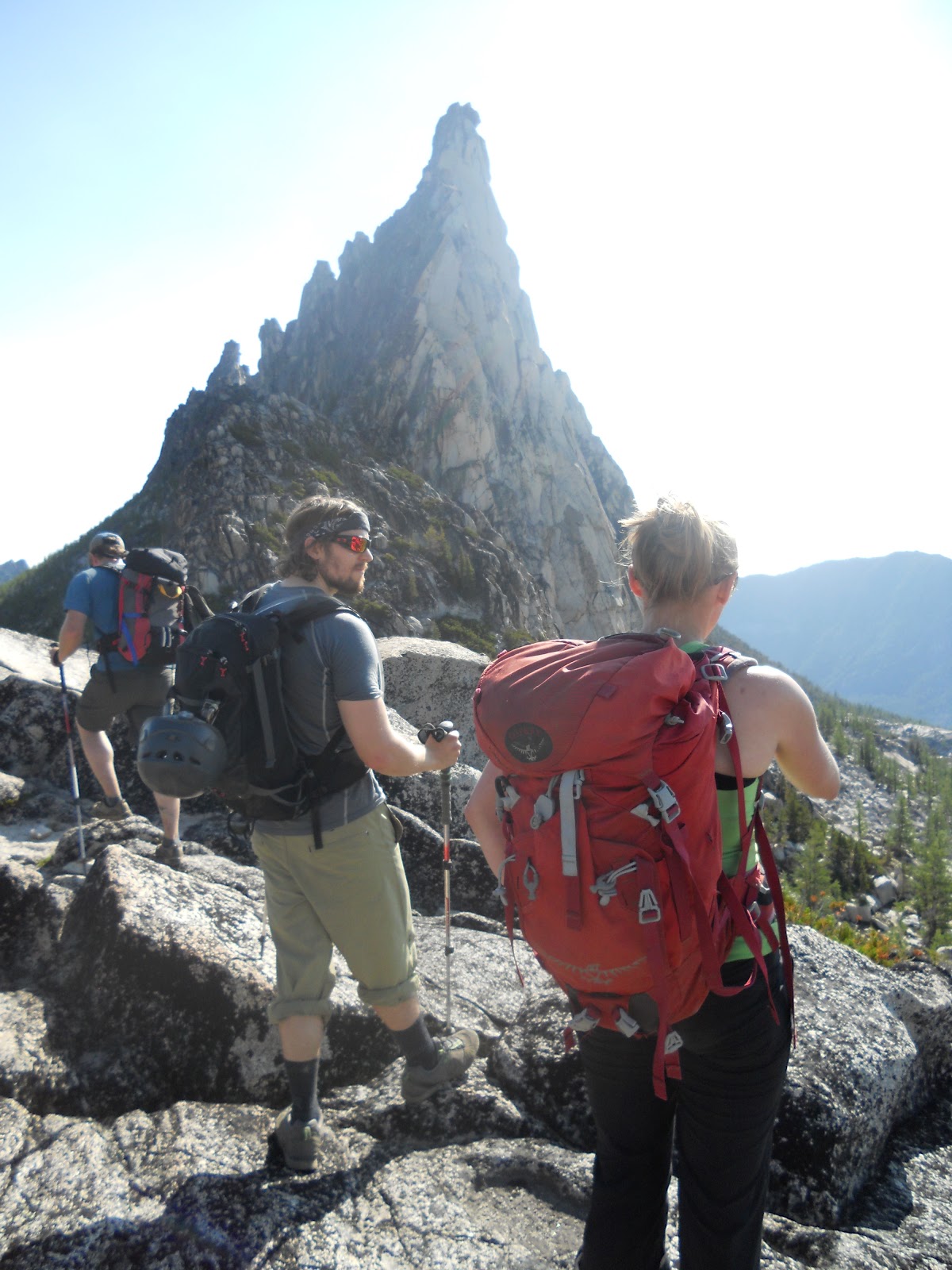
Evan, Kris, and Ava about 9.5 miles into the approach.  Prusik Peak in the distance.
Six hours after we started (10am), we were roped up and climbing.  Kris and Evan climbed as a team, and Ava and I climbed as a team.  Since the terrain was relatively easy as far as 5th class climbing goes, we "simul" climbed.  And by "simul", I mean that we pitched out the climbing but basically climbed side-by-side (Kris and I lead close together and Evan and Ava followed close together).

Starting out on the final pitch
After 5 pitches of climbing, we all arrived at the summit in fantastic spirits.  The weather was beautiful and not as overwhelmingly hot as we thought it was going to be.  I won't do a pitch-by-pitch, but suffice it to say that the climbing involved a bit of crack climbing, some face climbing, a little slab climbing, a chimney, and a super positive and fun lieback on a flake - all in only 5 pitches on fantastic rock in a picturesque, alpine setting.  We also didn't see anyone else on route, which we all found surprising given the popularity of the route.

High-spirited summit shot
After 4 single-rope rappels down the north side, we traversed back to where we started climbing on the west ridge and started retracing our steps.

Prusik Peak from the southwest (the West Ridge route follows the left skyline, often just off the crest on the opposite side)
We stopped for a short time at one of the many lakes in order to refill our water vessels and splash around.   Other than this, it was pretty much all business getting back to the car.  Fifteen hours and 20 miles after we started, we arrived back at the Stuart Lake Trailhead and the car.  We proceeded to drive into Leavenworth for a much-earned pizza feed before Mario Andretti . . . no, Bowser. . . wait, I mean Kris, drove us home to Seattle by 11:30 pm.

Although a long day, it was so enjoyable and beautiful it seemed to fly by.  There's really not much that can compare with an outing like this with great weather and even better company.

August 12, 2012

Joj-cel the Scrambler with Shoes On

If you don't get the title reference, please watch both of these:

Marcel the Shell with Shoes On (One) http://vimeo.com/33097773
Marcel the Shell with Shoes On (Two) http://vimeo.com/32189414

Now that we're all on the same page, I should inform you that the title is barely relevant.  During a recent NOLS rock camp in Leavenworth, I blew out my beloved pair of approach shoes (hiking shoes with sticky climbing shoe rubber, to the lay person).  I took Friday off since I have to work this weekend, so I planned a last-minute scramble, then realized I didn't have any approach shoes.  So I did what anyone else would do and left work at lunch time on Thursday to buy a new pair at REI.  I ended up buying the only pair they had in my size, which turned out to be a La Sportiva Boulder X.


The Plan: Climb a whole bunch of peaks in the Tatoosh Range, immediately south of and very close to Mt. Rainier.

Motivation: Perfect weather forecast, fun scrambling on "high quality choss" (if that's a thing), and spectacular views.

Details:

I started up the Pinnacle Peak trail at about 0730 and was quickly at the saddle between Plummer Peak and Pinnacle Peak.  I hung my pack in a tree and jogged up to the summit of Plummer and back.  Plummer was the least technical, so I felt good leaving my pack which contained, a rope, harness, and minimal amount of gear in case I needed to build an anchor.

Marcel the marmot with no shoes on
Back at the saddle, I didn't have far to go before the first of many "business ends" of the traverse began.  I went up the south face of Pinnacle on some loose-ish but never very steep rock.  From the top, I decided to explore the possibility of descending the east ridge.  I'd heard the east ridge was sporting to ascend, so I reasoned it would be at least as sporting to descend.  I was prepared to back off and descend the way I came up, but it never got very tricky, albeit exposed in places.

The views were okay
The distance from the base of Pinnacle's east ridge to The Castle's south face was negligible, so I was quickly scrambling back up more high quality choss.  My recollection of The Castle is that there were some steeper low 5th class moves, but the exposure was much less than on Pinnacle, making for some very enjoyable scrambling.

Pinnacle Peak (from The Castle)
I descended Castle using a slight variation from my ascent route.  My overall impression is that there are a multitude of possible lines on the south side of The Castle, all of which are equally difficult on similar and decent rock.

The Castle was separated from Unicorn Peak by a 2.5 mile-long ridge with two significant and unnamed peaks between them.  The first was an easy scramble up to point 6,254 feet, followed by a gradual descent and traverse across a beautiful, flat ridge covered in wild flowers.  Then I was going up again.

Throughout the day, the views failed to deteriorate

From a distance, the northwest aspect of Steepchoss Peak (this is what I'm calling the peak immediately west of Unicorn Peak, separated only by a single, prominent saddle) appeared rather intimidating.  I told myself that it only looked that way because I was looking straight at it, and that in reality is probably wasn't as steep as it looked from my vantage point.  So, with rope and harness at the ready for a possible bail, I started up old Steepchoss.  The first half of the ascent went great, and I was totally right about it not being as steep as it looked.  A little over half way up, there was a bit of a headwall of near vertical rock for about 30 feet.  I spent a bit of time wandering around looking for a reasonable way up.  I eventually found an easy but exposed weakness in the rock which led to easier ground and eventually the summit.


Handsome goat at the base of the Unicorn horn
The east side of Steepchoss was less steep but more chossy, so I decided to keep the name.  I carefully descended to the saddle from where Ava and I had skied down less than two months earlier.  From here, I knew the route to Unicorn, although it was a bit different in places with substantially less snow.

Optical illusion: the namesake horn on Unicorn Peak is not actually the same size as Mt. Rainier
When I got in view of the horn on Unicorn Peak, I heard what I thought was the first person I'd encountered all day.  I was wrong.  It was a goat.  Like a good, respectable goat, he kept his distance and posed for some photos.

Joji: Hey goat, why don't you be a little more photogenic.
Goat: Sure!  I'll just go skyline myself and turn broadside.
After the goat skittered across a snow patch and out of view, I continued to the horn and ascended the 4th class east ridge.  It felt a little 5th-classy, but that could have been due to the exposure to the north.  While the climbing is less interesting than the 5.6 south side of the horn, the view and position are superior.  Since this was the last summit of the day, it felt like summit of the trip (it also happens to be this highest point in the Tatoosh), so I took some obligatory summit photos.

On top of Unicorn Peak with the views still not sucking (photo courtesy of Tripod)
The adventure was not over.  I didn't feel good about downclimbing the way I came up, so I pulled out the rope for the first and only time of the trip and rappelled the south face.  From the base of the horn, scrambling down to the saddle (center of the photo below) was easy.  At the saddle I encountered my first snow of the trip.  It was sufficiently soft at the top to heel plunge, but as the angle steepened the north face phenomenon took over and the snow firmed up.  It firmed up to the point that I wish I had two things: crampons and boots that were compatible with them.  I was, however, minimally prepared for such conditions with an axe.

. . . and that's why they call it "Unicorn", like an air-breathing narwhal with hooves.  Steepchoss Peak is on the right.
The descent was slow for a couple hundred feet as I kicked steps and braced with the axe, eventually choosing hideous scree over more painstaking step kicking.  I made up some of the lost time with some top notch boot skiing a little while later.

I made it down to snow lake and jumped in just as soon as I could take my shoes off, temporarily making a lie of this post title.  The yelling idiots I encountered at Snow Lake successfully reminded me that I was in a National Park.  I owe them one for breaking me free from my delusions of wilderness adventure, possible preventing catastrophe as trip over a paved road and get hit by a car a mile down the trail.  Once I made it to the road it was an easy 2 mile walk back to my car.

I completed the trip in 7 hours and had a great time moving through the mountains, alone but for the occasional critter.  I love my new shoes and thought they performed very well.  They seem to have all the advantages of my late pair of approach shoes with improvements in the areas of edging on rock and step kicking in snow.  This also happened to be Ava's and my negative first wedding anniversary, so it was nice to be alone for the day with my thoughts (seeing as she was off teaching a backpacking trip for the Y, this seemed like the next best option).


July 12, 2012

Fourth Time's a Charm

I had previously tried to climb Mt. Rainier on three occasions: twice via Liberty Ridge on the north side of the mountain and once via the Emmons Glacier on the east side.  For the last several weeks I've had an itch to try and ski off of the summit, with the primary goal of actually making it there.  With shitty weather up until the 4th of July, last weekend was the first weekend suitable for such an attempt.

I sent out an email and quickly rounded up Brian and Rodrigo as climbing partners.  Ava decided to join us the evening before we left, making us a group of four.  I had decided to attempt the Emmons Glacier route because I was most familiar with it and it's also the least technical route on the mountain, making it more suitable for a less harrowing ski descent.


Who doesn't love sunrises at 12,500 ft?

The route ascends 10,000 vertical feet in about 8.5 miles.  Our plan was to head up to Camp Schurman (picking off about half of the elevation gain) on Saturday and summit and return to the car on Sunday.  Two solid days in a row, but manageable provided the altitude didn't twist our sea-level softened lungs up too bad.


We arrived at the Sunrise Ranger Station about 10 minutes before they opened (second group in line), and were the last group to receive a permit to camp at Camp Schurman.  Apparently the rest of Seattle was waiting for the first nice weekend of the year as well.


We may have put the skis on a little too early


With full packs on plus skis on our backs, we headed for Schurman.  About four miles later, at Glacier Basin, we were able to put our skis on and skin the rest of the way.  We intentionally maintained a leisurely pace the entire day to maintain energy for the following day.  Even so, we arrived at camp by 3:00, leaving plenty of time to melt snow, eat, and hydrate before going to bed.  Ava had developed a headache on the way up which worsened after we got to camp.  Rest, food, water, and Diamox eventually reversed this, but we all agreed it would be best if she didn't go up further.


Camp Schurman

That evening I chatted with the rangers staffing Camp Schurman about this ski conditions, what to expect, and when would be the best time to descend.  They recommended descending quite late (3pm) to allow as much of the ice up high to soften as possible.  I was also informed of the one crux of the route, a dicey little snow bridge that was about to melt out in awkward terrain with crevasses all around.  This would turn out to be the one and only place a skier would need to rope up on the descent.  As Brian and Rodrigo would not be bringing skis with them, I would be skiing alone and have no one to rope up with when I arrived at the crux unless I waited for them.  This, combined with the recommended late descent, made me decide to stash my skis just below the suspect snow bridge at about 11,700 ft.  I felt more relieved at going to bed with a concrete plan than disappointed about giving up on my hopes of a summit ski descent.


Brian, Rodrigo, and I got up at 1am and were moving up the mountain about 40 minutes later.  By the time we started, there was a pretty steady stream of headlamps from camp (9,500 ft) up to about 12,000 ft.  With Brian in the lead, we moved steadily up the lower part of the mountain, passing several slower groups as we went.  When we stashed my skis below the snow bridge at about 11,700 ft, we encountered a bottleneck that had been developing for some time.  We killed about 45 minutes here, which was frustrating but provided a situation where all we could do was eat and drink.  This extra eating and drinking came in handy as the day progressed.


While one would definitely want to be roped up for it, the bridge turned out to not be as bad as advertised.  The rest of the way to the top was sustained in steepness and littered with other climbers, all of whom seemed to be moving painfully slowly.  In several more places we were forced to wait as groups stopped in inconvenient spots for long periods of time - more eating and drinking.


Nearly the whole day the wind had been quite gusty, with frequent 25 to 30 mph gusts.  As we neared the top, we got reports from descending parties that the wind on the summit was horrendous.  After reaching the top of several false summits, we gained what seemed to be another one, only this time the wind was no longer gusting, it had turned into a steady 35 mph headwind.  A short walk through this wind on the rocky ridge of the crater rim brought us to the true summit at 14,410 ft.  We took a few quick pictures before retreating back to the leeward side of the mountain.


Brian, Joji, and Rodrigo at 14,410 ft in Washington
(I'm not mad, my face is just numb from walking into the wind so I couldn't control it)


Descending as a rope team always seems to take longer than it needs to, and this day was no exception.  We eventually made it back to the crux snow bridge and attempted to find an alternate passage.  An alternate passage we found, but it was arguably just as sketchy while being more technical - oh well.  After the bridge, Brian and Rodrigo dropped me off at my skis and continued descending.  I radioed Ava back at camp to inform her that I was going to start skiing, and she proceeded to take some video with the camera.  Unfortunately, I'm not visible in most of these because, although in a direct line of sight, I was too far away.  I descended the 2,200 vertical feet in about 5 minutes and was happy to rest in camp for a bit before continuing our descent.


Rodrigo and Brian showed up in camp about 25 minutes later looking like hell.  Apparently the sticky snow I had skied on the last 1,000 ft had been a postholing nightmare for the two of them, sapping the last of their energy.  Thankfully, Ava was an amazing camp host and already had lots of snow melted for water and was in the process of cooking up some pasta.  We rested, ate, and hydrated in camp for about two hours before continuing our descent.


Skiing down the Inter Glacier


The ski down from camp started out treacherously sticky, but counter-intuitively got better as we went down.  The Inter Glacier turns out to be a super fun, sustained pitch to ski even with a full pack.  Once back at Glacier Basin, we put the skis back on the packs, Ava and I switched to running shoes, and we hiked the last few miles back to the car.


Ridiculous


While nothing on the route was difficult, it did prove to be a beast of a hike with plenty of elevation gain.  I'm psyched to have made it to the top and  super happy with how well my body handled the altitude and the back-to-back long days.  Now it's time for some warm, sunny rock climbing.

July 02, 2012

Enchantment Traverse: Medium and Light Style

With mediocre weekend weather in store once again, Ava and I decided it would be a good weekend for a long hike.  We devised a plan to hike through the Enchantments in the Alpine Lakes Wilderness in a day, intent on going fast and light.  This is a more or less horseshoe shaped traverse, starting and finishing at two different trailheads about 8 miles apart.  The idea was to run/hike from the Snow Lake trailhead to the Colchuck Lake trailhead via the glorious Enchantment Traverse,and hitchhike back to the Snow Lake trailhead.  Reliable reports of the distance and elevation gain for the route were hard to come by.  My current best estimate is about 18-19 miles with 6,700 feet of elevation gain.

About 2 minutes into our run, we were forced to admit that hiking was a more appropriate mode of travel given the incline of the trail, our fitness level, and the long day ahead.  So, 2 minutes into the day we set a standard of overestimating our abilities and underestimating our adventure, which would last for the next 9 hours.

For the first several hours, we walked, ate, and drank in a repeating fashion as we ascended deeper and higher into the Alpine Lakes Wilderness.  As we neared what we thought was the halfway point, we were continuously assessing our decision to commit to the traverse or turn around and retrace our steps.  The main unknown in our decision centered around the fact that the highest point on the route, Asgard Pass at about 7,800 feet, would meet us at about mile 12.  Most of the trail was snow free, but we were unsure of how much snow the pass would hold and how steep of snow slopes we would have to travel on in our running shoes without ice axes.

With no shortage of people scattered about this popular wilderness destination, we stopped to ask people with a trustworthy appearance about the conditions on Asgard Pass.  Descriptions ranged from, "It's really steep and we heard you need spikes," to "It's not bad.  You should just go for it, but leave now because it's getting late and it will take you a while".

I failed to mention that we didn't leave the trailhead until 12:45, thinking we could optimistically complete the run/hike in 5 hours, maybe a couple more in a less optimistic, more realistic world.  I think it was about 6:45 when we were still 2 miles from the pass and asking backpackers what they knew.

One favorable report was all we needed.  Thankfully, that report came from a group of backpackers who had just come over Asgard Pass and left a nice trail of boot steps in the snow for us to follow.  Without their tracks in the snow, I'm sure we would have turned around as the navigation is less than straightforward up there and we were sans map and compass.

So, we kept walking, drinking, and eating, but now with a slightly higher degree of urgency.  We arrived at the top of the pass to be pleasantly surprised by finding the other side almost completely free of snow.  However, the reports of steepness were not exaggerated.  We descended about 2000 ft in the next mile, at which point we reached Colchuck Lake and the trail became much flatter and well-maintained.  We actually did run some of the last few miles to the trailhead, partly motivated by the waning light.

We arrived at the trailhead at 9:45, taking exactly 9 hours to complete the traverse.  Since it took us much longer than anticipated, our hitchhiking plan more or less turned to shit.  I'm sure many vehicles were travelling the gravel side road to and from the trailhead about 2 hours earlier, but that didn't do us much good.  So, we kept walking.

About 3 or 4 miles later, the first two vehicles travelling our direction approached.  The first drove by without slowing, but the second stopped and happily gave two smelly hitchhikers a much appreciated ride.

I think we traveled 22 miles in total, running for about 1.5 of those.  Despite our underestimation of our objective, we had a great day out and felt surprisingly good at the end.  Given the rugged nature of large sections of the trail, I don't feel too bad about our final time, even though it was much slower than expected.  While I can't call our speed fast, it also wasn't slow.  And since we didn't take very much with us, thereby travelling very light, I'm quite comfortable referring to our style as "medium and light".  I hope we inspire others to partake in this new offshoot style of backcountry travel.  It maintains many of the benefits of fast and light while proving to be much more pleasant and enjoyable.

June 18, 2012

What do you get when a narwhal mates with a horse?

With a suspect weather forecast, Ava and I opted to attempt to execute our plans of climbing Unicorn (yes, that's the answer to the title question) Peak in the Tatoosh Range, due south of Mt. Rainier.  We almost didn't bring our skis but ended up being really glad that we did as there was snow all the way to the parking area.

Most of the way up, the mountain was obscured by clouds.  The few moments of clarity we had barely lasted long enough to get a camera out, but I managed to be quick enough on the draw once or twice.

Unicorn Peak during a blessing of visibility
Shortly after that picture was taken the clouds came back in, engulfing not only the mountain this time, but us as well.  We managed to skin most of the way to the top, until the increasing slope and decreasing visibility (down to about 20 feet at times) inspired us to put our skis on our packs and our ice axes in our hands.

The top of the mountain, as seen in the first picture, is a rock pinnacle and the obvious namesake of the peak.  We opted for the 5.6 finish directly to the top from the south, which was great fun but depressingly short.   

Ava nearing the top of the horn
We encountered a moderately obnoxious group of Mazamas at the summit; obnoxious largely due to the fact that there were so many of them.  Luckily, they were all rapelling off the summit at the same time we were getting there, so we had plenty of uninterrupted time for rediculous summit shots.

Captain Lickey and Blue Steel
The summit of Unicorn is arguably home to the best views of Mt. Rainier.  Cursing the clouds didn't help, but at one point while on the summit, it did appear that there were rocks in the sky in the direction of the big mountain.  With a little bit of clearing down lower, the descent was pretty damn rad.

June 02, 2012

Snake Boatin'

A bunch of friends and I extended Memorial Day weekend to Tuesday and spent three days rafting the beautiful and mellow Hell's Canyon section of the Snake River.  The vegetation in the canyon was greener than I've ever seen it.  When we were rained on for much of our first day on the water, I figured out why.

The Crew (minus Steph)
Characters on this trip included Jake, Steph, Sara, Ken, Megan, Evan, Craig, Melinda, Sheri, Andrew, and me.  We made our way pretty leisurely down the river in one paddle boat, two gear boats, and two kayaks.  With flows around 14,000 cfs, the river was noticeably lower than last year when it was closer to 20,000 cfs.  In comparison, these lower flows seemed to make the two biggest rapids (Wild Sheep and Granite) a little mellower but compensated by creating a few interesting rapids further down river that I didn't remember.  One of these rapids further down river was the culprit of our only carnage of the trip, where the paddle boat tipped all the passengers out except for Steph, the paddle captain.  With everyone else downriver, the swimmers were quickly picked up and I don't think we lost anything except for maybe a pair of sunglasses.

Loading the Gearboats at the Put-In
Perhaps my favorite picture of the trip
Mr. Bacon Squared
The Greenness of Hell's Canyon in late May
This was the first raft trip I'd ever organized, and I had a great time doing it!  Thanks to help from Jake and Steph, we were able to gather all the gear we needed and we didn't seem to forget anything too major, or minor for that matter.  Much thanks to Steph's dad, as most of the gear we borrowed was his.  And yes, like all the other recent raft trips I've been on, I now want my own boat a little more than before.

April 10, 2012

April Blower Pow in the Washington Cascades

I'll be the first to admit that it's pathetic how long it's been since I've updated this blog.  It's no coincidence that the last time I posted was the day before I started my job. . . turns out my job, although satisfying, is not particularly blog worthy.  I've been skiing, typically with Ava, most every weekend this winter.  Unlike most of the country, Washington has not been snow deprived, particularly in the north.  Mt. Baker was claiming a base measurement of 315 inches (over 26 feet), which is positively stupid.

Thanks to Evan (and Earl, the God of weather) we actually got some decent pictures of our exploits last Saturday.  Although mostly sunny and fairly warm, the powder on the north facing slopes was surprisingly well preserved.  Kris, Evan, Ava and I took full advantage of this and had a glorious day up on Lichtenberg Mountain.


January 08, 2012

Powder in the North Cascades

Prior to starting my new job (tomorrow morning, as I type this), Ava and I got away for a long weekend.  We were planning to road trip to somewhere like Montana or Wyoming, but the complete lack of snow throughout the lower 48 made this unreasonable.  Conveniently, the only place with a decent snow pack as well as a promising weather forecast was the Mt. Baker area in northern Washington.

We ended up spending three nights in the town of Sumas (seven blocks from Canada), skiing at the resort on Thursday and hitting up the backcountry on Friday and Saturday.  When we returned home on Sunday, we read that there was 19 inches of fresh snow over the three days that we were out.  All we knew at the time was that the skiing was incredible!

Ava shredding the gnar

Yahoo pow pow!!!

December 02, 2011

Late Season Archery Elk

While researching the late season elk hunting opportunities in Washington, I generally found two types of opinions: 1) It's great!  I usually get my elk during the late season, and 2) It's nearly impossible to kill an elk with a bow during the late season - a total waste of time.  I hate to be a pessimist, but after 4.5 days of hard hunting I'm siding with the latter.

I hunted Sunday evening through Thursday morning this week near Yakima in the Cowiche unit.  I found my first animals mid day on Monday, which included five deer.  On Tuesday morning I spotted some elk!  I saw three or four though a narrow gap in the trees, but figured there were more.  They were about 1,000 feet above me, near the top of a ridge.  I knew they would move before I got there, but I had to make an attempt.  When I got close I found lots of sign, including tracks, fresh scat, and the smell of elk urine.  I followed their tracks and spotted them about 1.5 miles later at a much lower elevation.  I now counted between 20 and 30 altogether.  They were moving as if they were spooked, which was understandable given the amount of hunters around.  My goal was to figure out where they would spook to and get there before they did.  I ended up guessing about 100 yards off the mark as they crossed below me.  One cow got separated and was maybe 50 yards away, based on the sound of her call as I never saw her.  I attempted to get closer only to find her gone when I could finally see where I thought she was.

Wednesday was filled with furry animals, starting with jumping a black bear at 30 yards.  He stood up and slowly lumbered away.  Next I spotted a coyote with my binoculars.  After walking another hundred yards, I spotted another coyote.  A few miles later I jumped a deer at close range in thick forest.  A half mile after that I jumped a herd of elk, which crashed through the forest at close range but I never managed to see them.  After following their tracks for about a mile, I saw them trotting across an open area about 800 yards away.  When they disappeared over the ridge, I attempted to close the distance but never found them again.  By this point I was probably 6 miles from my camp.  On the way back, I spotted yet another coyote.

Thursday morning was entirely uneventful.  I think I walked between 50 and 60 miles this trip, all off-trail over hilly terrain.  While this effort didn't put any meat in my freezer, it effectively removed any Thanksgiving pounds I might have put on.  Kris and I will be heading out again this weekend to the same area.  I know there are elk there, they're just extremely good at hiding and extra wary after being shot at by rifle hunters for two weeks last month.

November 21, 2011

Ruttin' Rams and Raftin' Rivers

Like the previous 19 years, Jake once again put in for the lottery drawing to hunt Oregon Bighorn Sheep last year.  The odds of drawing are somewhere in the 1/100 to 1/200 range, so there is a good chance that he could have put in for this hunt for the rest of his life and never drawn.  However, in true Jake-luck fashion, he won the lottery.  The hard part was over.

Wanting to make the most of his luck, Jake put a ton of time into researching the unit for which he had drawn (West John Day).  This included talking with private landowners, people who had drawn the tag in recent years and local sheep hunting guides as well as studying maps and making a few scouting trips.  Prior to opening day, he accumulated 21 days of scouting via a series of multi-day float trips down the John Day River.

I received constant updates regarding his progress during this scouting process, including photos of named rams like Flair and Warrior.  Being the savvy hunter that Jake is, while he was scouting he was also trying to put together a strong team of support hunters for the actual hunt.  I knew Jake wanted me to join him, but until the last minute I wasn't sure if I would be able.

About a week and a half before Jake's planned departure date, things fell into place.  On November 7th we started floating down the John Day river in search of the largest ram in Oregon's West John Day unit.

Put-in on the John Day River
The Plan
All of Jake's research and scouting resulted in the following plan.  Jake and I would start floating down the river five days before opening day of the 9-day season.  We would float almost 40 miles in three days, passing several rams in the process, before arriving at Deep Canyon, which we would turn into basecamp.  Once here, we would begin our search for the larger rams Jake had seen on his scouting trip, including a ram he hadn't seen that was rumored to be the largest in the area (Rumor Ram).  Ideally, we would locate Rumor Ram before the season and shoot him on opening day.  One day before opening day, we would be joined by Jake's long-time hunting partner (Kyle) and Kyle's step dad (Loren).

The Team
Jake - As Jake drew the tag, his primary responsibility was to shoot the ram.  He also acted like the CEO, planning the hunt, building his team and organizing everything.
Kyle - With lots of hunting experience, Kyle would serve as a strong set of eyes to help spot the sheep as well as help with devising strategies for finding and shooting a giant ram.
Loren - Loren drew this exact tag in 2009.  Through a similar scouting/research process two years earlier, Loren learned the terrain and habits of the sheep well.  His knowledge and experience would make him a valuable member of the team, as well as his eyes.
Me - With less hunting experience than the other three, I would serve as an additional set of eyes, a rower, a pack mule, a calming agent during exciting times, and round out the team for convenient travel in pairs.

Air guitar?  Contrived and unnecessary.  We have a shovel.
Pre-Season
On the float down to Deep Canyon, we spotted 100's of sheep including many mature rams.  Jake had ambitions of shooting an Oregon state record ram with a bow, so we passed right on by many rams that most sane people would consider a trophy.  We stopped a couple of times to hike up side canyons, exhibiting due diligence so as not to blindly pass by any giant rams that may have eluded Jake on his scouting trips.

Sheep Everywhere
On our third day, we set up a luxurious camp at the base of Deep Canyon which would provide good access to the herd of sheep known to reside primarily between there and Willow Springs Canyon.  Unlike other animals I have hunted, the sheep here don't seem to travel more than a few miles, living their entire lives in a relatively confined area.

On November 10th we began the real leg work, with our primary goal of locating Rumor Ram as well as finding and keeping tabs on other large rams in the area.  In order to see lots of terrain, Jake floated the river in a packable kayak while I hiked to the top of the canyon and looked down at the same terrain Jake was looking up at.  While floating Jake located about 80 sheep, most of them in a single herd very near the river.  In this group was a ram that looked a lot like Flair (aka Ram-a-lamb-a-ding-dong), but appeared bigger!  We would later name this ram Elvis (The King), but I think he might have been the same ram as Flair.  It's also very possible that Rumor Ram = Elvis = Flair, but these are things we will never know for sure.  At any rate, Elvis was big enough that we would want to keep track of his whereabouts as he might very well be the largest ram in the area.

Jake hiking back to camp at sunset

On the 11th Jake and I both hiked to the top of the canyon and searched several miles of the adjacent Willow Springs Canyon (WSC) on our way to pay Elvis and the herd of 50 sheep a visit.  We saw two lone rams in WSC before finding the big herd in the same location as the previous day.  Only this time, Elvis was not with them.  We got within 200 yards of the herd to get a closer look, but Elvis wasn't there.  One ram wandered away from the herd and got within 100 yards of us before spooking and running back.

John Benet 'Ram'sy

We had perfect weather up to this point, but part way though the day the wind picked up.  On the hike back to camp we experienced gusts that we estimated at 70-80 miles an hour.  When we returned to camp, Jake's raft had blown about 100 feet up into camp and our kitchen was in shambles.  Our one saving grace was that Kyle and Loren showed up while we were out and rounded up many of the pieces of our kitchen.

Opening Day
On opening day Loren and I went back to watch the big herd and see if Elvis returned.  We saw five rams on the way there, and once again found the big herd right where we left them the previous evening.  Shortly after finding the herd, a ram we named Chip the previous day wandered by at close range.


Chip
Meanwhile, Jake and Kyle hiked upriver to ensure that we covered all areas that we thought might hold sheep.  They found none and by afternoon had hiked all the way to where Loren and I were.  We had just left the herd after watching them for a couple hours.  Jake and Kyle were tired of not seeing sheep, so they went out to the vantage point where Loren and I had been.  As soon as they got in view of the herd, they saw Elvis moving toward the herd form a ways off, coming in to see if any of the ewes were in heat.  When they radioed to say that they saw him, I immediately doubled back to join them and get a look at The King.

Elvis
At this point, we had about two hours of daylight left.  Jake thought this was enough time to put a stock on Elvis and try to get within bow range.  After Jake descended 1,000 feet and started to circle around, Kyle and I watched Elvis through the spotting scope turn his head and stare unflinchingly at Jake, 600 yards away.  Jake continued to circle around and come back up to join Kyle and me.  In the process, Elvis went back to join the herd and at one point Jake passed within about 250 yards of the big ram.

When all four of us went back to find Elvis and the big herd the following day, the herd was back but we never saw Elvis.  The wind that started the day before opening day had still not let up.

Day Three
The hike from camp to where the big herd was hanging out took about two hours of brisk hiking, more if you glassed for sheep along the way.  Jake was growing fed up with the wasted hours of daylight as we hiked back and forth, so we devised a plan for Jake to bivy at the top of the canyon above the herd for as many days as it took for him to kill the big ram.  Consequently, Jake and I got up at 3:00 am and hiked with full packs out to the point above the big herd before first light.  As the sun rose, we were disheartened to see no sheep where we had seen 40 to 50 each of the previous 4 days.

We spent a couple hours glassing the adjacent hillsides.  Jake spotted chip and several ewes way over on the other side of WSC as well as a few other small groups that we thought could very likely be splintered from the big herd.  It appeared the big herd had broken up, which would make it harder to relocate Elvis as the herd acted as a beacon that would draw him in a couple times a day to check on the ewes.

While Jake and I were out looking for the herd, Loren and Kyle had rowed across the river and were glassing the steep cliffs between camp and the last known location of the herd.  At around 9:30 am, Jake and I got in touch with Kyle and Loren on the radio.  They said they saw a "big, big ram" with several other rams that were also big, but at the distances they were looking they couldn't accurately identify him.  Even if it wasn't Elvis, Kyle's description involving two uses of the word "big" was enough to get Jake going in that direction.  We left Jake's pack and bivy stuff at the point and began working our way back along the ridge to where Kyle and Loren had seen the rams.

All of a sudden sheep were everywhere.  Some had crested the ridge and were heading down into WSC.  We saw about 10 sheep in WSC and expected to see the group of big rams there too.  When we didn't, we continued along the ridge.  As I followed directly behind Jake, he stopped suddenly.  He saw several sheep off the other side of the ridge (the John Day River side).  As I stayed back, Jake snuck in closer for a better look at what appeared to be about 30 sheep.

Due to the persistent winds as well as the terrain that Elvis was sticking to, Jake opted to put down his bow hunt with his rifle.

I knew they were close and was hoping that Jake was waiting for a clear shot at Elvis.  I thought I would hear a gun shot at any moment, followed by news on the radio that Elvis was down.  A few minutes later, Jake came crawling back through the grass.  He said it was definitely Elvis along with a ram he had previously named Warrior and several other rams and ewes.  He circled around to get in a better position as the sheep were sidehilling near the top of the canyon in the direction of camp.

Jake putting the sneak on Elvis
I remained out of site and once again hoped I would soon hear a gunshot.  Minutes later, I did!  I was convinced that Elvis's time was up.  Thirty seconds after the shot I saw Jake running back up the hill and circling around to get in better position for a follow up shot.  Then . . . nothing.  I turn on my radio to ask Kyle and Loren if they have any idea what's going on.  They said they were watching Elvis sidehilling back towards Deep Canyon, moving like he hadn't been hit.  When Jake and I finally reconnected we moved quickly back towards deep canyon in hopes of cutting Elvis off as made his way to wherever he was going.

Kyle and Loren did a good job of tracking his progress from the other side of the river and managed to guide us to his location as he ascended the hill and crossed into the plains at the top of the canyon.  So good, in fact, that Jake saw a flash of Elvis about 100 yards away as he leaped a fence, landed on private property, and continued sprinting out of site and perhaps out of the state.  We searched Deep Canyon for a while, but it seemed that Elvis stayed up on the plateau and didn't drop into it.

Bear in mind that there was a lot of confusion during this chase.  Was Elvis hit?  Were Kyle and Loren following the ram that Jake shot at or a different ram?  After things calmed down, Jake and I went back to where the ram was when he originally shot at it.  We found the exact location, followed his exit path for a few hundred yards, and found no blood.  It was a clean miss.

With all the stirring up we did, we decided there wasn't much reason for Jake to bivy, so we started back toward the point to retrieve his pack and head back toward camp.  On the way to our cache, Kyle, still on the other side of the river, got back on the radio and said, "This hunt isn't over yet.  That other big ram is still hanging out and I'm watching him."  After a minute or two of deliberation, Jake decided to go after Warrior, who we decided was the second biggest ram in the unit (maybe even the first since Elvis had left the building). I would continue out to the point, grab Jake's pack, and head back toward camp, intersecting Jake and Warrior along the way.

As I was nearing the place on the ridge where I thought Jake would be directly below me, I began hearing radio chatter.  I spoke with Kyle to learn that several shots had been fired, none of which I could hear due to the wind.  As I waited for another update, two more shots were fired only a few hundred yards from me, and I didn't hear these either.  Then I hear on the radio from Kyle that Jake has a ram down and they're crossing the river to join in the photo session and butchering.  I immediately grabbed my pack, Jake's pack, and Jake's bow and started down the hill to the location of Jake and his ram.

Left to Right: Back Row - Kyle, Loren, Jake, Josh     Front Row - Warrior
I arrived shortly before Kyle and Loren and helped Jake pull the ram out of the ravine that it fell into.  Kyle and Loren then arrived and we managed to get a metric shit tonne of photos just before it got dark.

Trophy Photo #1

Trophy Photo #2
After caping, butchering, and packing the ram out about 1.5 miles, we got back to camp around 8:30.  With our 3:00 am start, this made for a long day.  It felt great to have such hard work result in an edible reward.

All packed up and ready to leave base camp
Reflections
Overall, the trip was extremely enjoyable.  I feel very honored that Jake wanted me to be a part of this special, once in a lifetime hunt (he can never draw this tag again).  It also conjured up sentimental memories of Jake's late father and my dad, who both drew a Steens Mountain Oregon sheep tag in the same year about 25 years ago.  A year or two after their hunt, Jake and I went back to the Steens with them.  I have fond memories of being about 10 years old, glassing for sheep, fishing for trout, and porcupine hunting.  Whereas our fathers both hired guides and killed nice rams, Jake put this hunt together on his own, avoided paying landowners for access by floating the river, put the hunt together very inexpensively, and managed to kill one of the largest California Bighorns in the state.  Also, I can't say enough about how great it was to combine a multi-day rafting trip with a hunting trip.

On the more constructive side, this trip highlighted two things for me: the difference between bow hunting and rifle hunting, and the difference between trophy hunting and meat hunting.  Jake had the option to use a bow or a rifle on this hunt.  While he could have killed a ram with a bow, it would have been much more difficult and he would have had to lower his standards and be much more opportunistic.  As it was, he opted to maintain his ambitious goals and switch to a more powerful weapon.  We may have had to wait days just for the wind to die down enough to accurately shoot an arrow.  The sporting nature of the bow and arrow remains as appealing as ever to me, but at the same time I recognize that the "boom stick" is a more effective way to fill the freezer.

While Jake's goal to kill the largest ram in the unit created an excellent challenge, and I love a good challenge, I still lean toward my Darwinian hunting style.  For example, the big herd contained a good ram with an obvious limp.  My instincts told me that this was the ram to pursue, even if there was one with larger horns right next to him.  To select the largest, most fit ram and eliminate him from the gene pool seems contradictory to the natural order.  With that said, I understand that trophy hunting brings a ton of money to state fish and wildlife departments.  This money has a lot to do with why those animals are even there in the first place, so there is a positive side to trophy hunting too.  It's just not for me.  As a side, bighorn sheep were a native species in Oregon.  Humans impacted their numbers with uncontrolled hunting, but disease brought in by domestic sheep is what did them in.  They have since been reintroduced (form British Colombia, I think) and with careful separation with domestic sheep their numbers are coming back.

Congratulations to Jake for taking an impressive ram and putting together a great hunt!