April 19, 2011
Phase Next
I started a new job yesterday! After a few months of searching, I finally found an engineering company to take me in. I'm working as a Senior Staff Engineer for Icicle Creek Engineers. It's a small company (less than 10 employees) and is owned and run by a married couple. My office is currently in the basement of their house in Carnation, WA, so it's a bit of a commute but seems manageable so far. The work we do is centered around geology, geologic engineering, hydrogeology, and geotechnical engineering. The projects I will be working on are much smaller than I'm used to and have nothing to do with mining! Okay, some projects might be mining reclamation related, but that's cleaning up the mess rather than making it. I'm still hoping to teach the occasional NOLS course, and my new employers seem like they'll be willing to work with on that when the time comes.

April 13, 2011
Lots of Little Stuffs

Nothing crazy or super fun to report, but I've decided that several slightly important things have happened that cumulatively warrant a blog post.
I sold Quatra, my 4-Runner, over a month ago. I'm now trying to bike as much as possible and share Ava's car only when it's absolutely necessary. It's going well so far. Time will tell how long I can last without a vehicle, but it really doesn't make sense for us to have two cars when we seldom use one.
I went on another mission with Seattle Mountain Rescue to help two skiers down the mountain who were injured in an avalanche. http://www.komonews.com/news/local/119359894.html?tab=video This mission was more technical in nature than the previous one and, consequently, more fun.
A few days later, when avalanche conditions were lower, I went up to the same area with Dane as he passed through town on his way to Conway, WA. At about the same elevation the skiers triggered the avalanche, we encountered increasingly unstable conditions. We turned around here and got some decent powder turns in.
I went climbing with a bunch of friends at Vantage on Saturday. I'll be teaching a weekend climbing course there for The Overlake School in about a month, so it was good for me to learn the area a bit since I'd never climbed there before. A few weeks ago I taught my first course for Overlake, taking six students snow camping for a weekend up on Stevens Pass with one other instructor. This was my first non-NOLS outdoor education experience, and although quite different, it was equally fun and fantastically short.
I'm still in the job market for an engineering job, but in the meantime I will be an employee at Recreational Equipment, Inc., selling gear to people out of the Alderwood Mall location. I start training on Saturday.
It's 15.5 miles each way, mostly on the Interurban Trail, so it's a pretty good ride considering it's through the city. So, starting on Saturday, I'll technically have three employers: NOLS, The Overlake School, and REI. We'll see how the juggling act goes.
April 05, 2011
Seattle Mountain Rescue
About a year ago I joined Seattle Mountain Rescue (SMR), the King County search and rescue organization specializing in high angle and other technical rescues. Until last weekend, I had been quite inactive in SMR. This was largely due to the fact that I didn't live in Washington for most of that time as well as having some motivational challenges.
I spent last weekend (Friday night, all day Saturday and all day Sunday) participating in SMR's rigging for rescue training. It seems that most SMR training is focused on technical rigging systems for high angle rescue, yet most missions that we respond to are of a non-technical nature. On Sunday, after training in the field from 0730 to 1700, we were notified of a mission nearby. Someone had reportedly sustained a knee injury on top of Mt. Si, the trailhead for which was only about a mile away from where about 30 SMR members had just finished training.
We regrouped, shuttled over to the trailhead, and began heading up the trail in groups of 3-5 as soon as rescuers were ready. A few minutes after getting the initial call, I found myself hiking up the Mt. Si tail in the second group of SMR responders on my first mission. An hour and a half after that, we had hiked 4 miles and gained almost 4,000 vertical feet to our patient. The first group arrived at the subject's location a few minutes earlier and was well on their way to getting the patient packaged in the litter we had carried up.
After the subject was packaged, the real work began. We started by sledding the litter down the snowy/icy trail with a series of belays. Once we got below the snow, we added a wheel to the litter and continued down the trail with four people attending to the litter and about as many tending to the tag line (break) attached to the uphill side of the litter. As we descended, additional groups (some from SMR, and some from other King County search and rescue organizations) joined us. Eventually we had upwards of 35 rescuers switching out regularly as we transported the subject back to the trailhead, which we eventually reached at 2315.
I was super impressed with the SMR response as well as the blistering pace at which most of them walk, especially considering the long day we had already put in! I'm looking forward to joining more missions as the summer and "mission season" approaches.
I spent last weekend (Friday night, all day Saturday and all day Sunday) participating in SMR's rigging for rescue training. It seems that most SMR training is focused on technical rigging systems for high angle rescue, yet most missions that we respond to are of a non-technical nature. On Sunday, after training in the field from 0730 to 1700, we were notified of a mission nearby. Someone had reportedly sustained a knee injury on top of Mt. Si, the trailhead for which was only about a mile away from where about 30 SMR members had just finished training.
We regrouped, shuttled over to the trailhead, and began heading up the trail in groups of 3-5 as soon as rescuers were ready. A few minutes after getting the initial call, I found myself hiking up the Mt. Si tail in the second group of SMR responders on my first mission. An hour and a half after that, we had hiked 4 miles and gained almost 4,000 vertical feet to our patient. The first group arrived at the subject's location a few minutes earlier and was well on their way to getting the patient packaged in the litter we had carried up.
After the subject was packaged, the real work began. We started by sledding the litter down the snowy/icy trail with a series of belays. Once we got below the snow, we added a wheel to the litter and continued down the trail with four people attending to the litter and about as many tending to the tag line (break) attached to the uphill side of the litter. As we descended, additional groups (some from SMR, and some from other King County search and rescue organizations) joined us. Eventually we had upwards of 35 rescuers switching out regularly as we transported the subject back to the trailhead, which we eventually reached at 2315.
I was super impressed with the SMR response as well as the blistering pace at which most of them walk, especially considering the long day we had already put in! I'm looking forward to joining more missions as the summer and "mission season" approaches.
February 25, 2011
Deep Pow
This is what I remember winter in the Pacific Northwest being like. Jake came up to visit for a good part of this week. Avy danger was high the whole time but we did get out on Wednesday for some mellow turns up on Snoqualmie Pass.


 |
| Jake is in there somewhere |

February 21, 2011
New Stuffs
I officially now live in Seattle (the north part of the University District, to be more precise). Ava and I are renting the lower level of a giant, old house. The owners, who bought the place only a few months ago, live upstairs and are remodeling the entire house. Luckily for us, they remodeled the basement first so we essentially live in a brand new apartment. It feels great to have all my stuff in one place. The efficient design makes the scant 570 square feet seem much bigger. Add efficient appliances and radiant heating to the efficient space, and this is about as "green" as its location is awesome. Much thanks to Ava's parents for helping us furnish the new place!
We had a great ski day up on Snoqualmie Pass a couple days ago. The snow was about as good as it gets in Washington, and we miraculously had an entire backcountry slope all to ourselves. We skied three laps on a north facing slope about two miles from I-90 and never saw another person or another set of tracks.
In other news, I cleaned up Quatra yesterday and posted her on Craigslist, asking Kelley Blue Book value. People are now fighting over my 4Runner, so I'm guessing I won't have a car by the end of the week. The plan is to see how long I can handle getting around on a bike before getting another oil guzzler.
We had a great ski day up on Snoqualmie Pass a couple days ago. The snow was about as good as it gets in Washington, and we miraculously had an entire backcountry slope all to ourselves. We skied three laps on a north facing slope about two miles from I-90 and never saw another person or another set of tracks.
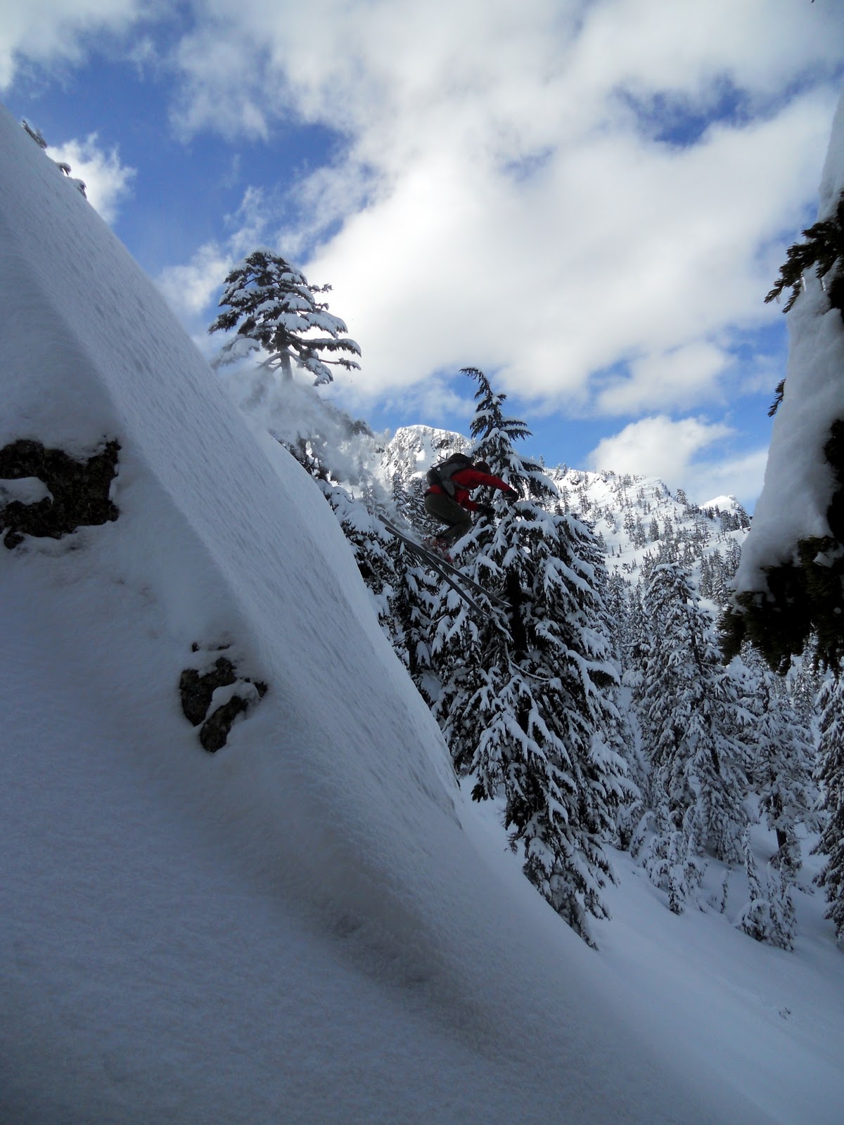 |
| Yay for soft snow to land in! |
In other news, I cleaned up Quatra yesterday and posted her on Craigslist, asking Kelley Blue Book value. People are now fighting over my 4Runner, so I'm guessing I won't have a car by the end of the week. The plan is to see how long I can handle getting around on a bike before getting another oil guzzler.
February 12, 2011
NOLS in Winter with R2D2
 |
| Bleep bleep bloop blap! |
I spent the later half of January and a few days of February in an intensive NOLS training seminar. And by intensive, I mean skiing powder in the Tetons most every day for three weeks. The first week was a professional level 1 avalanche training which I found extremely useful and learned a lot from. The final two weeks was spent ski touring a loop in Grand Teton National Park (GTNP) where we were provided ample time to practice what we had learned during the previous week.
During the avy 1, we skied every day. Most days were good, but one day was great! We spent most days skiing on and around Teton Pass as the NOLS base is in Driggs, ID. One day we went to GTNP, which happened to be the day it snowed about 14 inches. My group skied a popular route known as Maverick and had some of the best snow I've ever skied.
 |
| Skiing Maverick in GTNP. Three cheers for Teton cold smoke! |
In preparing for the next section (the WIS, or winter instructor seminar), we decided that our team name would be the Rocketships. With two groups of four and a group of three comprising the Rocketships, we naturally needed names for all the groups. I ended up in the Millennium Falcon, after the famous Star Wars ship. Coincidentally, Ava and I had just finished watching all six Star Wars episodes shortly before I left. This started a theme for the trip that would pervade the remaining 12 days.
The first day of the next section was spent at Grand Targee Ski Resort, where we spent the first half of the day learning how to teach both alpine and telemark skiing progressions and spent the second half of the day learning how to make ourselves better skiers/teach more advanced telemark students. The day was beautiful and I was pretty impressed with the 'Gee, as some locals call it.
 |
| Grand Teton from Grand Targee |
 |
| Inside our first quinzee/cave |
 |
| Sledding loads from our first base camp to our second |
On the last day of the trip before heading out, we skied enjoyable powder on northern aspects, which was quite amazing considering it hadn't snowed measurably in two weeks.
 |
| Sweet north facing lines in 2-week old powder (mine are the furthest right :) |
On January 28th, after several days of overdoing the whole theme (my name was Chewie and the other three members in my group were Leia, Han, and Luke), we all woke up inside the snow cave to the sound of the Star Wars theme song. After several seconds of thinking we were crazy, I realized that the sound was coming from my bag of papers/notes/etc. Turns out the birthday card Ava had me bring along got set off inside of its envelope and happened to be a musical Star Wars card with a light up light saber on the front. Best and most unlikely coincidence of my life. After opening the card on my birthday the following morning, it was played nearly constantly as well as used to light up the inside of the snow cave in a beautiful shade of light saber green.
Prior to leaving our final dig-in location, several models were created including a death star, star destroyer, millennium falcon, and a life-size R2D2. I can proudly claim the R2D2 as my own. Hopefully the first picture now makes since to all who managed to read this far.
We skied out without incident, completing a riotous time in the backcountry with a fantastic group of people. I'm now cleared to teach winter courses for NOLS, but perhaps more importantly, I feel compelled to spend at least one winter in the Tetons at some point in the future.
December 07, 2010
Winter
Upon exiting the Grand Canyon and returning to the Pacific Northwest after Thanksgiving, it dawned on me that it is now winter for all intents and purposes. So, naturally, on my first weekend back in Seattle Ava and I went ice climbing on Saturday and skiing on Sunday.
We weren't sure if the ice was in up at Snoqualmie Falls, but since it is only about an hour away we decided to go check it out.

We ended up finding lots of thin ice covered in snow. I'd say it was climbable, but not exactly "in". We climbed 30 meters up the ice before deciding to rappel before committing to a second pitch of thin ice. The crux of this trip was post-holing up the approach. It turned out to be easier to increase your surface area by crawling rather than sink balls deep when trying to walk. Ava thought I looked a bit ridiculous, so she took a short video.
We made it back to Seattle on Saturday just after kickoff of the Civil War, surprised to find the Beavers off to an early 7-0 lead. That didn't last long, as expected, but I was happy to see the Beavs try to make a game out of it. If it wasn't for the turnovers verging on double digits, it would have been quite interesting. Congrats to Nike, oops, I mean the Ducks for making it to the National Championship! I hope they decide to play 4 quarters against Auburn.
On Sunday we got up early, rounded up 8 people in 2 cars, and drove to Mt. Baker for some backcountry skiing. We ended up skiing three laps in quite good but skied out snow on Table Mountain. I was impressed by the magnitude of the backcountry scene up at Baker. It was pretty ridiculous how many people were out skinning up the hill, refusing to buy a lift ticket at the adjacent resort.
Even with good snow, great weather, and even better company, I was most impressed by the views! Previously, I had only been up to Baker once before when it was raining with no visibility. This time I got to be wowed by the proximity of Mt. Shuksan (not to mention Mt. Baker and the rest of the North Cascades).
To summarize my life right now, I'm spending most of each weekday searching and applying for engineering and teaching (community college) jobs. I'm slowly moving in to an extra room at a friends place, and playing hard on the weekends when everyone I know up here has free time.
We weren't sure if the ice was in up at Snoqualmie Falls, but since it is only about an hour away we decided to go check it out.

We ended up finding lots of thin ice covered in snow. I'd say it was climbable, but not exactly "in". We climbed 30 meters up the ice before deciding to rappel before committing to a second pitch of thin ice. The crux of this trip was post-holing up the approach. It turned out to be easier to increase your surface area by crawling rather than sink balls deep when trying to walk. Ava thought I looked a bit ridiculous, so she took a short video.
We made it back to Seattle on Saturday just after kickoff of the Civil War, surprised to find the Beavers off to an early 7-0 lead. That didn't last long, as expected, but I was happy to see the Beavs try to make a game out of it. If it wasn't for the turnovers verging on double digits, it would have been quite interesting. Congrats to Nike, oops, I mean the Ducks for making it to the National Championship! I hope they decide to play 4 quarters against Auburn.
On Sunday we got up early, rounded up 8 people in 2 cars, and drove to Mt. Baker for some backcountry skiing. We ended up skiing three laps in quite good but skied out snow on Table Mountain. I was impressed by the magnitude of the backcountry scene up at Baker. It was pretty ridiculous how many people were out skinning up the hill, refusing to buy a lift ticket at the adjacent resort.
 |
| Ava skinning up the hill, followed by a sliver of Adam |
 |
| Mt. Shuksan from the Mt. Baker ski area (which isn't really on Mt. Baker) |
December 02, 2010
More Grand Canyon Pics
Molly posted a bunch of her pictures on Flickr that do an excellent job of capturing the general mood and scenery of the trip.
http://www.flickr.com/photos/mollyelliott/sets/72157625511526986/show/
http://www.flickr.com/photos/mollyelliott/sets/72157625511526986/show/
December 01, 2010
Grand Canyon 2010 - A Moderately Functional Shitshow

On Halloween, fifteen of my best friends and I launched our boats at Lee's Ferry on the Colorado River as we set off on a 21-day raft trip down the Grand Canyon. Our water craft consisted of five 18-foot gear boats, one kat boat, and 4 kayaks. We were outfitted by Moenkopi Riverworks for a very reasonable price, and they did a wonderful job. Thanks to their planning and organization, our trip went very smoothly despite our level of functionality.
The crew and their boating responsibilities are listed below:
Gear Boat Captains: Jake, Garrett, Lane, Lou, and Josh
Kat Boat: Keith
Kayakers: Kyle, Turin, Phil, Becca
Extra rowers and passengers: Molly, Jasmine, Paco, Dane, Logan, Pete
A year and a half prior to the trip, we all put into the National Park Service (NPS) lottery for a chance to float down the river. Dane ended up being the lucky one, drawing the launch date of Halloween. As the designated trip leader, Keith chose Moenkopi as our outfitter and coordinated all the logistics with them. When we showed up at the put-in on October 30, they had all our gear, food, and beverages there waiting for us and the boats mostly rigged. After a 1-hour meeting with a couple of NPS Rangers the following morning, we set off down the river.
 |
| Provisions |
Boating Mishaps
Mishap 1 is credited to Louie for putting an 18-inch slice in the side of his gear boat on Day 10. Three patch attempts and one layover day later, it was like it never happened. Kudos to Logan for his amazing sewing of the gash prior to the third patch attempt.
Mishap 2 is credited to Jake for being the sole cause of our only flipped gear boat. We encountered the most difficult rapid of the trip, Lava Falls, on Day 18. He flipped in the very last hole in the rapid, effectively forcing himself and his two passengers to swim. Also swimming were two oars and an upside-down gear boat. The two oars were never recovered, but everything else turned out great! I was actually glad Jake bumbled this rapid because I wanted to experience the righting of a fully laden gear boat. It was surprisingly easy and I ended up learning a lot from this experience. Thanks Jake!
 |
| Me rowing one of the rapids earlier in the trip with Molly and Paco in the front |
Pretty much all the pictures in this post are courtesy of Kyle Dickman, who writes and shoots for Outside Magazine. He did an incredible job throughout the trip of getting in position and taking some great shots! However, Becca gets credit for the following video of me rowing through Lava Falls with Jasmine, Molly, and Paco in the bow.
As a group, we did an excellent job of being functional when we needed to be. Lucky for us, this only constituted about 4 hours over the course of the trip. The weather was fantastic with highs in the 70's and lows at night around 40. We had two minor sprinkles until the last night, when it rained constantly from sundown to sunup. As it turned out, this was way more pleasant than the summer time temperatures ranging from 85 to 130 degrees.
 |
| Typical beautiful flatwater section (90% of the river is like this) |
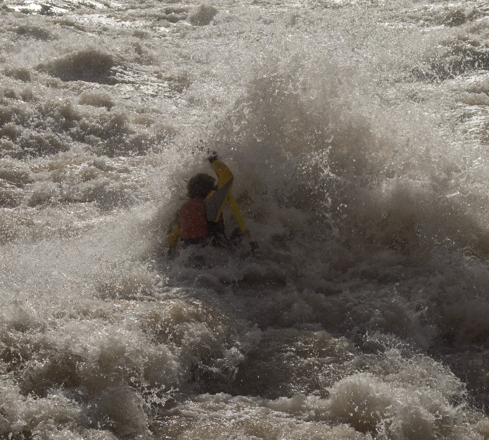 |
| Garrett dabbling in the anti-flatwater. Somewhere underneath him is an 18' gear boat. |
We ran Lava Falls in small groups so we could watch each other row the gnar. Kyle ended up taking a metric shit-ton of photos, getting a great sequence of stills of pretty much all the rafts going through the first two big holes. I posted my favorite below, but the whole sequence of my run is posted on Picassa.
 |
| You can barely make out the three heads in the front of the boat of Molly, Paco, and Jasmine. |
Enough about the rafting. The side hikes were at least as memorable. Unfortunately, my first camera battery failed and I lost my second one (found it three days before the end of the trip), so I didn't take any photos of the cool places I hiked to. We typically hiked in small groups and sometimes solo, so relying on Kyle for amazing photos didn't work out for me. Let's go ahead and call that "Hiking Mishap #1, courtesy of me". Every hike I did was worth doing. For my own future reference, the two hikes I did not go on that I feel I need to do next time (provided there is one) are Kanab Creek and Olo Canyon. My "favorite spot of the trip" award goes to a place 5.5 miles up Havasu Creek, where a clear side stream cascades about 25 feet into the turquoise main stream, about 200 yards below the impressive Mooney Falls, where the entirety of Havasu Creek flows over a 210-foot drop.
 |
| Picture stolen from the internet. The waterfall is cool by itself, but the double waterfall view just downstream is exquisite. I almost had a "Rainbow Guy" moment. |
Nominated for "Picture of the Trip" was this shot Kyle took at the base of Havasu Creek.

On the last night of the trip, on a recommendation from our outfitter, we ate an early Thanksgiving dinner before launching just before dark. We proceeded to float the last 40 miles in the dark with all the boats tied together. An hour later it started to rain, at which point we set up a total of 6 tents on the 5 boats. If it wasn't for the occasional rock bump on the edge of the river, you couldn't tell you were floating from inside the tent. A half hour after daylight, we pulled over at the take out, 40 miles below our last camp. This gave us just enough time to de-rig the boats before our shuttle arrived. Four hours later, we were organizing our personal gear in Flagstaff where there was an inch of snow on the ground.
My personal goals for the trip were to become proficient at rigging and rowing rafts. I met these goals to the extent that I now feel I need to buy my own raft, which I'm not sure is a good thing when viewed from a financial perspective.
Rumor has it that drawing Grand Canyon raft permits will become easier now that lottery preference is not given to people who used to be on the wait list. Consequently, I predict this trip or something very similar will occur on about 5-year intervals. Personal trips down the river become quite manageable and easy to organize when a good outfitter is employed.
October 21, 2010
Denali V3.0 - 12 Days at 14K
Day 5
We spent our fifth day on the mountain and first day at 14K actively acclimating. And by actively acclimating, I mean sitting around, eating, drinking, and sleeping. We did go on a short, flat ski over to the Edge of the World and back. The Edge of the World is simply the abrupt transition from the flat basin that contains Basin Camp to the steep ruggedness that is most of the mountain.
Our plan for the next day was to head up the West Rib a ways and scout the route we hoped to take to the summit. Fresh snow and a little weather changed our plans.
Day 6
Instead of heading right out of camp toward the West Rib, we opted to ski left toward the fixed lines that mark the standard route up the mountain, the West Buttress. We went up the fixed lines to 16,200 feet where the ridge of the West Buttress is officially gained, then hiked along the ridge to 17,200 feet where most parties climbing the West Buttress route set up their final camp before making a summit attempt. From here, the Rescue Gully leads straight down to Basin Camp in a short, steep, 3,000 foot drop. We figured this would be a good trial run for the lines of the Messner Couloir and the Oreint Express that we hoped to ski down from near the summit later in the trip.
The ridge from 16,200' to 17,200' is by far the neatest part of the West Buttress route. It's the only stretch that feels more like climbing than hiking and the feeling of walking on a sidewalk dissipates. The guided parties have placed and left protection along this stretch, which was nice to clip into on the way up but not entirely necessary.
We learned a lot by skiing the Rescue Gully. First, the steepness at the top emphasized the seriousness of skiing the bigger lines above 14K. Second, the spots that looked like blue ice from Basin Camp really were blue ice and impossible to hold an edge on. We received good reports from parties who had recently climbed the gully regarding a lack of blue ice that was so prevalent on the rest of the visible aspects from 14K. This turned out to be mostly true, with a couple of exceptions.
Long story short, our experience on a 3,000' descent with very little blue ice caused us to reevaluate our ambitions for skiing either of the two main lines off the summit plateau, which would be 5,000' descents with substantially more blue ice. Overall, it was a fun acclimatization day with some exciting skiing that I don't regret doing.
Day 7
Our seventh day on the mountain consisted of a scouting/acclimatization trip to 16,200 feet on the West Rib and setting up our cook tent. Clouds moved in when we were about half way up to the rib, making the scouting trip almost useless. Once we gained the rib, the visibility ranged from none to mediocre. During one of the mediocre times we were able to make out the first part of the climb on the ridge proper, which we decided was good enough for our scouting purposes. We proceeded to ski down most of the way to camp in a whiteout, which we referred to as braille skiing since we were forced to feel our way down via our skin track because everything else was equally white. Finally, about 700 vertical feet before reaching camp, the clouds lifted to provide us with several turns of amazing powder!
Upon returning to camp, all the clouds lifted, revealing our pathetic ski tracks. It was obvious looking at our tracks where we became able to see. We spent the remainder of the day setting up our cook tent and building protective walls with snow blocks around it. For the rest of our stay at 14K we would have a relatively warm and windless place to cook our meals.
Day 8
We'd yet to have a full rest day where we didn't do anything active, and Dane was fairly insistent that we do this. Thinking we might make a summit attempt the following day, we rested, ate, drank, and did a little work fortifying the walls for out cook tent.
We had heard conflicting weather reports from two equally unreliable sources about the next couple of days. We were trying to remain optimistic about the weather, but the lenticular cloud sitting on top of the mountain that evening made this difficult. We felt that we were now acclimated well enough to reach the summit, but we would also need some cooperation from the weather gods.
Day 9
When our alarm went off at 3:00 am, we looked outside our tent to find clouds engulfing the Upper West Rib. We opted to sleep in as we had many days of food left to wait for a more ideal weather window. We skied halfway up to the West Rib to get our legs moving once again and had yet another braille ski down for about 1,200 vertical feet.
That evening, the updated weather forecast for the following day looked much more promising.
Day 10
Similar to the day before, we set our alarms for 4:00 am. Upon looking out of the tent, we saw clear skies in most directions with the exception of the West Rib, our intended summit route. I convinced Dane that this was similar to the weather the previous day where it just got nicer all day long, so we started preparing to make our move. By 5:45 we were kicking steps in ankle to shin deep snow towards the West Rib. We didn't bring skis as we had previously decided not to attempt a summit ski descent, and we would be descending the West Buttress, thereby not passing by our stashed skis had we chosen to approach with them.
The farther we went, the deeper the snow got. Wallowing our way up to the West Rib made us appreciate how much easier all our traveling on skis had been. We took turns breaking trail / kicking steps in about 1 hour cycles for the majority of the day. The ridge was breezy when we reached it, and the sun had not yet hit so things got cold fast. For the first time all trip, I put on my super warm mittens, which I found to be extremely warm and extremely difficult to function in. After adding some layers, Dane took the lead as we began up the most technical (only technical) part of the climb from about 16,200' to 17,000'. The views during this section were beautiful and often airy.
After this fun bit, we proceeded to wallow another 2,500' to gain the summit plateau, the top of the Upper West Rib route, where we joined the West Buttress route at an area known as the football field. Wallowing from 17,000' to 19,500' up 40 to 45 degree snow was exhausting to say the least. It took us just over 13 hours to reach this point, making it 7:00 pm.
We spent an hour huddling in the inescapable wind and cold on the football field, trying to eat and drink enough to recover from our previous 13 hour ascent. We weren't sure when we reached the football field if we would continue to the summit or immediately descend the standard route 5,300' back to camp. After eating, drinking, and assessing the route and our situation, I decided I felt good enough to make the summit, 800' above us, and still have enough reserves to make it back to our camp at 14K. Dane, having less of a peak bagging drive than me, decided he'd rather go down. Since we were now on the main route, traveling solo seemed prudent enough, so I went up while Dane went down, with the intentions of stopping when he got out of the wind so we could continue the descent together once I caught up to him.
At 9:15 pm on May 30th, I stood on the summit of Denali at 20,320'. I was all alone and for probably the first and only time on the entire trip, I couldn't see a single other person. I took a few pictures but didn't waste too much time as it was already late and I knew Dane was huddled in the cold somewhere waiting for me.
I had taken three Advil after gaining the West Rib at about 16,500', which seemed to keep altitude sickness at bay. This is not to say that I didn't feel any effects of altitude, or perhaps altitude combined with exhaustion. As I neared the summit, my level of apparent tiredness receded. I was stoked to finally be at the summit, knowing that it was all downhill from here.
This next bit will sound overly dramatic and cliche, but I'll try to explain what I was feeling anyway. On the way down, I remember feeling like there was a separation between my mind and body. Like my mind knew exactly what I needed to do (get down the mountain to my sleeping bag), and it forced my body to comply with its wishes. Like my body cared that I was really tired but my mind was unsympathetic. I'm not sure how else to better describe it, but after descending about 1,000 feet from the summit, as my summit "high" wore off, this is how I felt the rest of the way down.
I met up with Dane at Denali Pass (18,200') on the West Buttress route. The route was very well wanded, easy to follow, and non-technical. When I found him, he was wearing all of his clothes and curled in a ball like an Alaskan sled dog, sound asleep. Unable to escape the wind, he had just curled up behind a small rock and let the spindrift blow in around him. When I woke him, he cleared the snow that had accumulated between his eyes and his glacier glasses and we descended together.
We made good time on the way down until we got to the base of the fixed lines, only about 1,200 feet above camp. At this point, I was so tired I could only walk for a few minutes before needing to rest. I remember counting 100 steps, resting, and repeating. Dane wasn't moving a whole lot faster. We ended up reaching Basin Camp at 1:30 am, just under 20 hours after leaving. Although we experienced nice weather the whole time we were gone, we found the tent covered in 8 inches of snow when we returned. I'd never before experienced fatigue like this. I needed food, water, and sleep. Sleep won, as I promptly crawled into my sleeping bag and passed out. I think Dane managed to eat something before joining me.
Day 11
So excited for a rest day! Dane could not resist the urge to ski the fresh powder that accumulated during the previous day, so he went up toward the West Rib and got a few turns in. I was still too tired to join him and my legs too sore.
Day 12
The last rest day felt so good, we decided to have another to celebrate the first day of June. It snowed off and on all day, but we still went out for a short ski toward the fixed lines. It was good to get the legs moving again, and I felt better than I thought I would.
Day 13
Best powder day of the trip! We skied two laps for a total of about 3,000 feet up toward the fixed lines and my legs felt great. The morning was noticeably colder than previous mornings, which probably just made the powder that much better. Dane is feeling good and has decided he might regret returning home without tagging the summit. The weather looks good for tomorrow, so we set the alarm for another early start.
Yes, we ate well. In true NOLS fashion, we alternated cooking on a dinner-breakfast schedule so we always cooked two meals in a row but never two in the same day. The bacon grease made everyone downwind from us jealous.
Day 14
I got up around 7:00 to make Dane a hearty breakfast before he made a solo summit bid from our 14K camp. By 8:30, he was off at a brisk pace, beating the hoards of people to the base of the fixed lines on the West Buttress route. Since we had descended the entire route the previous day, we knew it was safe enough and within Dane's ability to solo to the summit and back.
As Dane moved rapidly up the West Buttress, I went back to sleep. A few hours later, I got up and began ascending to 17,200', where I planned to meet up with Dane on his way down. It was a real nice day until about 3:30, when the anvil shaped clouds that had been threatening all day finally engulfed me in fog and light snow. Up higher, as Dane later reported, the weather was still clear. I waited at the 17,200' camp where a few dozen climbers were camped for 3.5 hours before Dane showed up at 6:15 pm.
After refueling at 17,200' we descended back to 14K, arriving at 8:00 pm, giving Dane an official and respectable round trip time of 11.5 hours to summit from 14K.
When we returned to camp, we noticed that the Lou Dawson crew had moved in next door. Lou is a well known ski mountaineer in Colorado. He had been to Denali once before and failed to reach the summit. This time he was back with his son and a slew of great young skiers from the Aspen area in attempt to ski off the summit. I knew they were going to be up there, so it was great to meet them all before we left. Several days after we left, most/all of them climbed and skied down all the skiable parts of the West Buttress route. Even with some additional snow, the more coveted lines off the summit plateau were still out of condition for them.
Day 15
It was looking like the mediocre weather that moved in yesterday was around to stay for a while, so we decided to spend one final day at 14K before descending back to the landing strip. We spent a bunch of time in the Dawson party's big cook tent, sharing stories, listening to music, and drinking the rest of our whiskey. We ended up giving most of our extra food and fuel to them as well to avoid carrying it down the mountain.
Day 16
We woke up to find Dawson's party tent flattened by about a foot of fresh snow. Later, this new snow would fuel and avalanche starting in the Messner Couloir and running straight towards the crowded Basin Camp, stopping plenty early but creating a bit of a scare nonetheless. We spent the morning packing up and getting rid of the last of our extra food. Dane was not looking forward to snowboarding down with a sled, so he strapped everything to his pack in epic junkshow fashion. I stacked his sled in mine and skied down using the "bad dog" technique, which worked wonderfully.
In a couple hours we descended from 14,200 feet to Camp I at 7,800 feet. Shortly before reaching Camp I, we ran into a NOLS group heading up the mountain. Dane knew one (or perhaps both) of the instructors who were taking about 8 members of the Indian Air Force up the West Buttress route. The route from Camp I to Kahiltna International Airport was back on the massive/flat expanse of the Kahiltna Glacier, which had been actively melting for the last 16 days. This made traveling on the glacier much more suspect with large, sagging areas in the snow that indicated enormous (100' wide) snow bridges. Observing this, we roped up and put our skins on, which slowed us down considerably. We encountered people heading up who were not roped up nor wearing skis, and we thought they had a death wish. We confirmed with the base camp rangers that several people had been "popping through" these snow bridges, some of them with skis on, so we're confident we made the right decision.
After charging up Heartbreak Hill, the section of the Southeast Fork of the Kahiltna Glacier that is uphill on the way back, I think we were looking at a 6 to 7 hour descent from 14K. I once again began to feel bad for the poor people on snowshoes, but then reminded myself that it was their own fault for not skiing.
We inquired with the climbing rangers at KIA about conditions on Mt. Hunter, which we hoped to climb if both the weather and climbing conditions looked good. After hearing about all the avalanches coming down our intended route due to the recent warm temperatures and getting a strong recommendation not to climb, we went to talk to the base camp manager about getting a ride back to Talkeetna.
Due to the weather, climbers had been stacked up waiting for a flight out for the last three days. This was the first day of flyable weather, so there was a whole slew of flights earlier in the day. By the time we got there at about 7:00 pm, everyone was cleared out and we were on a plane in less than an hour.
Day 17 and Beyond
With several extra days before our scheduled flight back to Denver, we decided to hitchhike around Alaska after spending a day in Talkeetna taking care of our gear. First, we went up to Fairbanks to visit a friend of mine from Boulder who grew up there and happened to be home visiting his parents. We then made it down to Homer, where we spent a bunch of time relaxing and met up with the Fry's at their Bear Creek Winery. Several logistical complexities later, we were at the airport in Anchorage with all of our gear, ready to fly back to the lower 48.
We spent our fifth day on the mountain and first day at 14K actively acclimating. And by actively acclimating, I mean sitting around, eating, drinking, and sleeping. We did go on a short, flat ski over to the Edge of the World and back. The Edge of the World is simply the abrupt transition from the flat basin that contains Basin Camp to the steep ruggedness that is most of the mountain.
 |
| The Edge of the World |
After enjoying the views for a while, we realized we could see Camp I down at 7,800 feet, 6,300 feet almost directly beneath us.
 |
| View of Foraker and the Kahiltna Glacier from The Edge of the World |
We also spent part of this day familiarizing ourselves with Basin Camp. There were close to 150 people here for the entirety of our stay at 14K, including a simi-permanent National Park Service ranger camp. As far as I could tell, the purpose of the ranger presence is to help ensure that climbers are following the rules (mainly waste disposal related), maintain the shitters, and coordinate rescues. They also post a weather report every day, which is highly unreliable at best, but nonetheless nice to have.
 |
| Weather Board |
 |
| One of two shitters (note that there's a high traffic trail right about where this picture is taken from). Modesty has no place here. |
Day 6
Instead of heading right out of camp toward the West Rib, we opted to ski left toward the fixed lines that mark the standard route up the mountain, the West Buttress. We went up the fixed lines to 16,200 feet where the ridge of the West Buttress is officially gained, then hiked along the ridge to 17,200 feet where most parties climbing the West Buttress route set up their final camp before making a summit attempt. From here, the Rescue Gully leads straight down to Basin Camp in a short, steep, 3,000 foot drop. We figured this would be a good trial run for the lines of the Messner Couloir and the Oreint Express that we hoped to ski down from near the summit later in the trip.
 |
| Skinning up to the base of the fixed lines on the West Buttress route |
 |
| Looking at 14K from the base of the fixed lines, Mt. Hunter in the background |
 |
| Dane leading the ridge from 16,2 to 17,2 |
 |
| Looking down the ridge at about 16,800' |
 |
| The top of Rescue Gully (picture taken on day 14) |
Day 7
Our seventh day on the mountain consisted of a scouting/acclimatization trip to 16,200 feet on the West Rib and setting up our cook tent. Clouds moved in when we were about half way up to the rib, making the scouting trip almost useless. Once we gained the rib, the visibility ranged from none to mediocre. During one of the mediocre times we were able to make out the first part of the climb on the ridge proper, which we decided was good enough for our scouting purposes. We proceeded to ski down most of the way to camp in a whiteout, which we referred to as braille skiing since we were forced to feel our way down via our skin track because everything else was equally white. Finally, about 700 vertical feet before reaching camp, the clouds lifted to provide us with several turns of amazing powder!
 |
| Route from 14K to the Upper West Rib on the skyline |
 |
| Setting up the cook tent |
We'd yet to have a full rest day where we didn't do anything active, and Dane was fairly insistent that we do this. Thinking we might make a summit attempt the following day, we rested, ate, drank, and did a little work fortifying the walls for out cook tent.
 |
| Rest Day |
Day 9
When our alarm went off at 3:00 am, we looked outside our tent to find clouds engulfing the Upper West Rib. We opted to sleep in as we had many days of food left to wait for a more ideal weather window. We skied halfway up to the West Rib to get our legs moving once again and had yet another braille ski down for about 1,200 vertical feet.
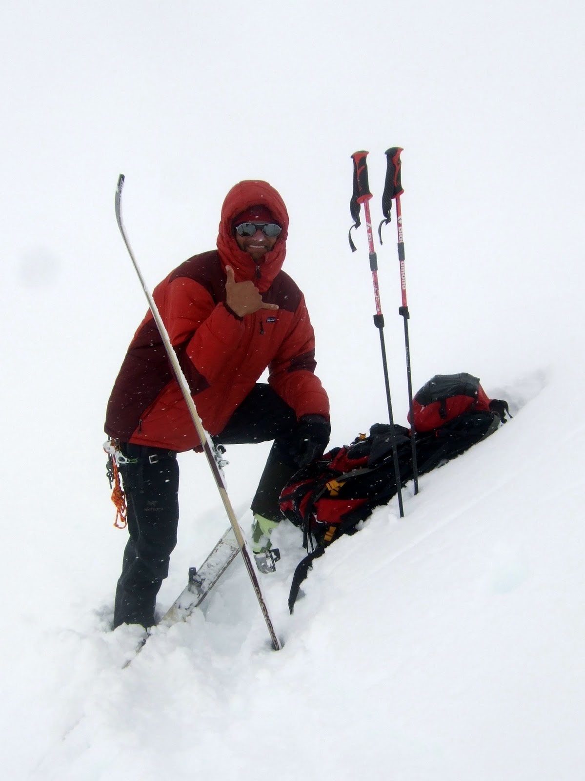 |
| Switching into downhill mode in the whiteout |
Day 10
Similar to the day before, we set our alarms for 4:00 am. Upon looking out of the tent, we saw clear skies in most directions with the exception of the West Rib, our intended summit route. I convinced Dane that this was similar to the weather the previous day where it just got nicer all day long, so we started preparing to make our move. By 5:45 we were kicking steps in ankle to shin deep snow towards the West Rib. We didn't bring skis as we had previously decided not to attempt a summit ski descent, and we would be descending the West Buttress, thereby not passing by our stashed skis had we chosen to approach with them.
 |
| Looking toward the West Rib from camp in the early morning of Day 10 |
 |
| Dane leading up after gaining the West Rib |
 |
| Looking down after climbing a couple hundred feet up the ridge |
We spent an hour huddling in the inescapable wind and cold on the football field, trying to eat and drink enough to recover from our previous 13 hour ascent. We weren't sure when we reached the football field if we would continue to the summit or immediately descend the standard route 5,300' back to camp. After eating, drinking, and assessing the route and our situation, I decided I felt good enough to make the summit, 800' above us, and still have enough reserves to make it back to our camp at 14K. Dane, having less of a peak bagging drive than me, decided he'd rather go down. Since we were now on the main route, traveling solo seemed prudent enough, so I went up while Dane went down, with the intentions of stopping when he got out of the wind so we could continue the descent together once I caught up to him.
 |
| Classic arms length summit shot |
At 9:15 pm on May 30th, I stood on the summit of Denali at 20,320'. I was all alone and for probably the first and only time on the entire trip, I couldn't see a single other person. I took a few pictures but didn't waste too much time as it was already late and I knew Dane was huddled in the cold somewhere waiting for me.
 |
| View from the top of North America |
 |
| Proof that I really was there |
This next bit will sound overly dramatic and cliche, but I'll try to explain what I was feeling anyway. On the way down, I remember feeling like there was a separation between my mind and body. Like my mind knew exactly what I needed to do (get down the mountain to my sleeping bag), and it forced my body to comply with its wishes. Like my body cared that I was really tired but my mind was unsympathetic. I'm not sure how else to better describe it, but after descending about 1,000 feet from the summit, as my summit "high" wore off, this is how I felt the rest of the way down.
I met up with Dane at Denali Pass (18,200') on the West Buttress route. The route was very well wanded, easy to follow, and non-technical. When I found him, he was wearing all of his clothes and curled in a ball like an Alaskan sled dog, sound asleep. Unable to escape the wind, he had just curled up behind a small rock and let the spindrift blow in around him. When I woke him, he cleared the snow that had accumulated between his eyes and his glacier glasses and we descended together.
We made good time on the way down until we got to the base of the fixed lines, only about 1,200 feet above camp. At this point, I was so tired I could only walk for a few minutes before needing to rest. I remember counting 100 steps, resting, and repeating. Dane wasn't moving a whole lot faster. We ended up reaching Basin Camp at 1:30 am, just under 20 hours after leaving. Although we experienced nice weather the whole time we were gone, we found the tent covered in 8 inches of snow when we returned. I'd never before experienced fatigue like this. I needed food, water, and sleep. Sleep won, as I promptly crawled into my sleeping bag and passed out. I think Dane managed to eat something before joining me.
Day 11
So excited for a rest day! Dane could not resist the urge to ski the fresh powder that accumulated during the previous day, so he went up toward the West Rib and got a few turns in. I was still too tired to join him and my legs too sore.
 |
| Celebratory whiskey and cards - what rest days are all about |
The last rest day felt so good, we decided to have another to celebrate the first day of June. It snowed off and on all day, but we still went out for a short ski toward the fixed lines. It was good to get the legs moving again, and I felt better than I thought I would.
Day 13
Best powder day of the trip! We skied two laps for a total of about 3,000 feet up toward the fixed lines and my legs felt great. The morning was noticeably colder than previous mornings, which probably just made the powder that much better. Dane is feeling good and has decided he might regret returning home without tagging the summit. The weather looks good for tomorrow, so we set the alarm for another early start.
 |
| Good morning Dane. Your cheesy fried bagel with sausage fried in bacon grease is ready. |
Yes, we ate well. In true NOLS fashion, we alternated cooking on a dinner-breakfast schedule so we always cooked two meals in a row but never two in the same day. The bacon grease made everyone downwind from us jealous.
 |
| Dane shredding the gnar |
 |
| Me, almost needing a snorkel |
I got up around 7:00 to make Dane a hearty breakfast before he made a solo summit bid from our 14K camp. By 8:30, he was off at a brisk pace, beating the hoards of people to the base of the fixed lines on the West Buttress route. Since we had descended the entire route the previous day, we knew it was safe enough and within Dane's ability to solo to the summit and back.
 |
| Dane looks like a little spec as he races toward the fixed lines. |
As Dane moved rapidly up the West Buttress, I went back to sleep. A few hours later, I got up and began ascending to 17,200', where I planned to meet up with Dane on his way down. It was a real nice day until about 3:30, when the anvil shaped clouds that had been threatening all day finally engulfed me in fog and light snow. Up higher, as Dane later reported, the weather was still clear. I waited at the 17,200' camp where a few dozen climbers were camped for 3.5 hours before Dane showed up at 6:15 pm.
 |
| Clouds chasing me up the ridge from 16,2 to 17,2 |
 |
| Dane's summit shot! |
 |
| Looking down the summit ridge |
After refueling at 17,200' we descended back to 14K, arriving at 8:00 pm, giving Dane an official and respectable round trip time of 11.5 hours to summit from 14K.
When we returned to camp, we noticed that the Lou Dawson crew had moved in next door. Lou is a well known ski mountaineer in Colorado. He had been to Denali once before and failed to reach the summit. This time he was back with his son and a slew of great young skiers from the Aspen area in attempt to ski off the summit. I knew they were going to be up there, so it was great to meet them all before we left. Several days after we left, most/all of them climbed and skied down all the skiable parts of the West Buttress route. Even with some additional snow, the more coveted lines off the summit plateau were still out of condition for them.
Day 15
It was looking like the mediocre weather that moved in yesterday was around to stay for a while, so we decided to spend one final day at 14K before descending back to the landing strip. We spent a bunch of time in the Dawson party's big cook tent, sharing stories, listening to music, and drinking the rest of our whiskey. We ended up giving most of our extra food and fuel to them as well to avoid carrying it down the mountain.
Day 16
We woke up to find Dawson's party tent flattened by about a foot of fresh snow. Later, this new snow would fuel and avalanche starting in the Messner Couloir and running straight towards the crowded Basin Camp, stopping plenty early but creating a bit of a scare nonetheless. We spent the morning packing up and getting rid of the last of our extra food. Dane was not looking forward to snowboarding down with a sled, so he strapped everything to his pack in epic junkshow fashion. I stacked his sled in mine and skied down using the "bad dog" technique, which worked wonderfully.
 |
| Junkshow |
After charging up Heartbreak Hill, the section of the Southeast Fork of the Kahiltna Glacier that is uphill on the way back, I think we were looking at a 6 to 7 hour descent from 14K. I once again began to feel bad for the poor people on snowshoes, but then reminded myself that it was their own fault for not skiing.
 |
| Back at KIA |
Due to the weather, climbers had been stacked up waiting for a flight out for the last three days. This was the first day of flyable weather, so there was a whole slew of flights earlier in the day. By the time we got there at about 7:00 pm, everyone was cleared out and we were on a plane in less than an hour.
Day 17 and Beyond
With several extra days before our scheduled flight back to Denver, we decided to hitchhike around Alaska after spending a day in Talkeetna taking care of our gear. First, we went up to Fairbanks to visit a friend of mine from Boulder who grew up there and happened to be home visiting his parents. We then made it down to Homer, where we spent a bunch of time relaxing and met up with the Fry's at their Bear Creek Winery. Several logistical complexities later, we were at the airport in Anchorage with all of our gear, ready to fly back to the lower 48.
 |
| Summit Shot, courtesy of Nancy Holliday |
Subscribe to:
Posts (Atom)
