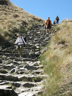
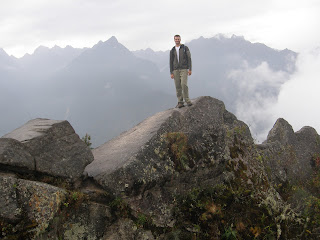
For the third and final leg of our trip to Peru, I signed us up for a 6-day rafting trip on the Apúrimac River. I had expected a very popular and crowded trip on par with the Grand Canyon or the Pacuare in Costa Rica. On the contrary, Dad and I were the only two clients in our group, which was supported by a head guide, a gear boat oarsman, a safety kayaker, and a cook. By the end of the trip, we were quite surprised to have only seen one other rafting group in 6 days, and they were camped out near one of the rapids looking for a body that had disappeared about 2 months prior.
I found the first day of our trip to be extremely entertaining, despite the fact that we only rafted for about 1.5 hours. The six of us plus a designated driver packed into a medium sized van with the remainder of the inside and top of the van maxed out with deflated boats and gear for 6 days. Up until this point, we had not been off of what I would call the "tourist trail'. We drove for a little over 3 hours from Cusco, and before we even left the city we were seeing Peruvians engaged in common activities, immersed in their own culture without the overwhelming influence of tourism. I was excited to see Peruvian culture, and things only got better the further we drove. After about 2 hours we stopped in a town that was having a huge festival, complete with ancient ritualistic dances and music. And the best part was that they weren't doing it just so tourists would throw them a couple dollars (we were the only two tourists in the town, and they weren't expecting us)!
After losing several thousand vertical feet while descending into the small village of Naywa in the bottom of the Apúrimac River Valley (this bit of driving was the scariest part of the trip), we got out of the van and spent the next couple of hours hauling our gear from the town to the river (about a 20 minute walk each way). The Naywa locals, including the 60-year-old women, put us to shame as they carried about three 60-pound loads each. One of the men, who weighed about a 120 pounds, made three trips in which he managed to carry two 100 pound dry boxes and the 110 pound raft. I think Dad and I combined to carry a kayak, a pump, and a small backpack.
First camp site
The guide, Boris, was a good boater, but he seemed to lack organizational skills. There was a lot of dirking around while they tried to figure out how to load their boats each morning. The best episode of dirking occurred in the first class 5 rapid. The video below shows the safety boater's run, which was very smooth. As the guide made us walk around the rapid, he was tasked with getting the raft down by himself.
He shot for the middle slot, same as the kayaker, only to find that it wasn't wide enough. He ended up getting out of the boat and pushing the raft over from the barely covered rock just to the right of the boat in the photo below.
After pushing the raft over while holding onto the bow line, the boat proceeded to go downstream with more force than Boris could handle. Had his foot not been wrapped around the tail end of the bow line, I'm sure he would have just let it go and let the kayaker run it down. As it was, letting go was not an option. What happened next was such a cluster I can't describe it. Suffice it to say that he eventually got his foot untangled, let the raft go, and escaped with only rope burns on his hands.
Over the course of the trip, there were 6 5th class rapids and the guide made us walk around all but one of them. I thought this was bull s@*! and basically told Boris so, but he wouldn't let us paddle them anyway. I've done enough rafting with Keith to know when something is runnable, and all of them were runnable in my opinion.
On the fourth day we stopped by a side creek and hiked up it a short ways to a waterfall. This reminded both Dad and me of the side hikes in the Grand Canyon.
Classic example of a Peruvian road switchbacking down a steep face
Early on the morning of the 5th day, two British clients joined our group as we had come to the first road crossing since we started. They did surprisingly well over the next 2 days, considering that neither of them had ever rafted before and the final two days were non-stop class 3 and 4 rapids.
When we started the trip, the rock was mostly black granite and conglomerate. About half way through the trip it changed to this white granite, coinciding with a steepening of the canyon walls.
This class 5 by the name of Toothache looks really fun. Unfortunately, the guides were once again selfish and made us walk around. The rock sticking up to the left of the raft in the photo is the tooth.
Everything went very well and was basically too safe. We remained healthy and uninjured all the way to the take out. Upon carrying the raft up the hill at the take out, I had a vicious encounter with a mean stock of bamboo. I came out victorious after breaking the bamboo stock clean in half, and all it managed to do was slice the top of my foot open.
After setting the raft down I took a look at the top of my foot, and immediately knew something was wrong when I noticed that I could see 1/4 inch into my foot. Luckily we had beer and Dad brought his 1st aid kit. A week later, after returning to Boulder, I decided that my foot was hurting more than it should and went to see a doctor. The doctor opened up the wound, pulled an inch of bamboo 'debris' out of the top of my foot, and sent me home. The wound is now healing well, and the nerve damage seems to get better every day.
September 27, 2008
September 26, 2008
O-bama
Manu - Response to Comments
There seems to be some question as to what Macaws sound like. This video should help clear things up, so long as the sound on your computer is turned on. And I didn't bring home a monkey because you explicitly told me not to, rashly claiming that that they have diseases and Cota would just eat it anyway.
September 24, 2008
The Amazon - Manu Wildlife Reserve
The second leg of our trip involved flying east from the middle of the Peruvian Andes down into the Amazon jungle, about 40 minutes away. This sub-trip lasted 4 days, and the amount of wildlife and biodiversity we saw was nothing short of spectacular.
After arriving on a primitive landing strip cut out of the jungle, we took a boat for an hour and a half down the Madre de Dios River to the lodge where we would spend most of our time. On the boat trip to the lodge, we saw many birds, a river turtle, howler monkeys, and lots of evidence that we were at the tail end of the dry season. The river in this area reportedly rises about 15 feet in the wet season.
Giant log that floated down the Madre de Dios River when the water was just a tad higher
Howler Monkeys on the side of the river
Whenever we weren't doing something else, we were either eating or walking around the jungle in the vicinity of the lodge, looking for whatever wildlife chose to present themselves.
Fist-sized butterfly
Perhaps the main attraction of this particular lodge, and the primary reason we chose it, is due to its proximity to one of the largest Macaw clay licks in the Amazon. Macaws are large parrots with about a 3 foot wingspan. They, along with a few other species in the jungle, eat a regular diet of toxic fruits. In order to counteract these toxins, the parrots take part in an unbelievable clay-eating ritual every morning at the exact same spot. The content of the clay neutralizes the toxins, allowing the parrots to live to see another day.
Macaws as they inch towards the clay lick
The daily ritual involves meeting up in the treetops above the preferred bank of clay. Smaller green and blue-headed parrots take their turn first, as they seem to be less afraid of the eagle and hawk threat. The Macaws slowly inch downward toward the clay, praying that another of them will be the first to make the move to the more-exposed and dangerous clay lick. We watched them take over an hour to inch towards the lick, just to have an egret fly overhead and scare them all back into the treetops. Another hour and a half later, the bravest one began the festivities, with the remaining couple hundred quickly to follow.
More Macaws
Mmmmmm, clay
Video of the ritual
On the boat ride from the clay lick back to the lodge, we saw a capybara on the side of the river. He was a goofy looking critter (as seen in the photo) and happens to be a member of the largest family of rodents in the world.
Capybara (extra large rodent)
We spent the following night sleeping out at a clay lick belonging to the tapirs. Although the tapir has a similar diet to the macaw, thus requiring the neutralizing clay lick, they are nothing alike. Tapirs are related to both the rhinoceros and the horse. We got to see one for about 5 seconds via a spotlight around midnight. Hiking back to the lodge, we saw several frogs and our guide managed to coax a few tarantulas out of their holes.
The primary event of the following day was to tour a nearby lake in search of more wildlife, in particular the 6-foot-long giant otter. We never saw an otter, but the trip was still quite eventful with monkeys all over the place, more birds than you could shake a stick at, and a rare and brief sighting of a tree-dwelling ant eater. I had fun pretending to be a wildlife photographer.
Huazins at the lakeside
Heron
Great White Egret (I can't figure out how they stay so clean)
Weird lookin' duck
Lilly pad bird, for lack of a better name
On the boat ride back to the landing strip, we thought we had seen all the animals we would find for the trip. Not so. An unusual weather pattern, or perhaps it was just something in the air, brought the caiman out. We saw nearly a dozen on the 2 hour boat ride, every one of them holding real still, looking like a log, and smiling.
Caiman
After arriving on a primitive landing strip cut out of the jungle, we took a boat for an hour and a half down the Madre de Dios River to the lodge where we would spend most of our time. On the boat trip to the lodge, we saw many birds, a river turtle, howler monkeys, and lots of evidence that we were at the tail end of the dry season. The river in this area reportedly rises about 15 feet in the wet season.
Giant log that floated down the Madre de Dios River when the water was just a tad higher
Howler Monkeys on the side of the river
Whenever we weren't doing something else, we were either eating or walking around the jungle in the vicinity of the lodge, looking for whatever wildlife chose to present themselves.
Fist-sized butterfly
Perhaps the main attraction of this particular lodge, and the primary reason we chose it, is due to its proximity to one of the largest Macaw clay licks in the Amazon. Macaws are large parrots with about a 3 foot wingspan. They, along with a few other species in the jungle, eat a regular diet of toxic fruits. In order to counteract these toxins, the parrots take part in an unbelievable clay-eating ritual every morning at the exact same spot. The content of the clay neutralizes the toxins, allowing the parrots to live to see another day.
Macaws as they inch towards the clay lick
The daily ritual involves meeting up in the treetops above the preferred bank of clay. Smaller green and blue-headed parrots take their turn first, as they seem to be less afraid of the eagle and hawk threat. The Macaws slowly inch downward toward the clay, praying that another of them will be the first to make the move to the more-exposed and dangerous clay lick. We watched them take over an hour to inch towards the lick, just to have an egret fly overhead and scare them all back into the treetops. Another hour and a half later, the bravest one began the festivities, with the remaining couple hundred quickly to follow.
More Macaws
Mmmmmm, clay
Video of the ritual
On the boat ride from the clay lick back to the lodge, we saw a capybara on the side of the river. He was a goofy looking critter (as seen in the photo) and happens to be a member of the largest family of rodents in the world.
Capybara (extra large rodent)
We spent the following night sleeping out at a clay lick belonging to the tapirs. Although the tapir has a similar diet to the macaw, thus requiring the neutralizing clay lick, they are nothing alike. Tapirs are related to both the rhinoceros and the horse. We got to see one for about 5 seconds via a spotlight around midnight. Hiking back to the lodge, we saw several frogs and our guide managed to coax a few tarantulas out of their holes.
The primary event of the following day was to tour a nearby lake in search of more wildlife, in particular the 6-foot-long giant otter. We never saw an otter, but the trip was still quite eventful with monkeys all over the place, more birds than you could shake a stick at, and a rare and brief sighting of a tree-dwelling ant eater. I had fun pretending to be a wildlife photographer.
Huazins at the lakeside
Heron
Great White Egret (I can't figure out how they stay so clean)
Weird lookin' duck
Lilly pad bird, for lack of a better name
On the boat ride back to the landing strip, we thought we had seen all the animals we would find for the trip. Not so. An unusual weather pattern, or perhaps it was just something in the air, brought the caiman out. We saw nearly a dozen on the 2 hour boat ride, every one of them holding real still, looking like a log, and smiling.
Caiman
September 20, 2008
El Camino Inca (The Inca Trail)
Along with 6 other Oregon dentists and their wives, my dad and I hiked for 4 days on the Inca Trail to reach Machu Picchu. As is now required by law, we were accompanied by a guide, an assistant guide, and 15 porters. Although several hundred people begin this hike each day (I think 500 is the limit, including porters), we didn't encounter very many people due to the fact that we started about a half-day further away on the trail, so we were continuously 1/2 day behind nearly everyone else.
Urubamba River Valley, near the start of the trail
The first day's hike was short and flat and served as a bit of a warm-up. Here we learned the routine of the porters carrying 70 pound packs and running in sandals. Some of them would stop at a predefined location and prepare a nice, hot lunch for us while the others continued to camp and had everything set up for us when we arrived. We also learned that the record time for completing the trek we were hoping to complete in 4 days is just over 3.5 hours. The porters were truly amazing and I would like to have brought one home with me.
Ruins near camp 1
Q'Entimarka Ruins near camp 1
We saw over 10 ruins in 4 days before arriving in Machu Picchu. Many of the ruins along the trail were quite extensive and really neat to see because there were no roads to them. Despite there not being any roads, small towns of only a couple families each were encountered sporadically throughout our trek.
The entire second day was spent hiking about 4000 vertical feet up a river valley, towards the highest point on the trail. We stopped to camp, as planned, about 1700 feet below the pass, leaving a fair bit of climbing for the next morning. I was able to convince the guides to let me do a side hike up to some ruins (Willkarakay) that do not lie on the main trail. This proved to be a fun experience as the ruins turned out to be in a fairly early state of the archaeological dig. I thought I was by myself when I came around a corner of a rock wall and found a donkey chillin' in one of the small rooms of the ruins.
Typical trail on day 2
We camped at about 12,000 feet that night, causing some members of the group to have mild symptoms of altitude sickness. A couple of other members of our group were stricken with GI issues, which was everyone's nightmare heading into the trip. Apparently porters have carried sick and wounded gringos before, but nobody had to resort to that on our trip.
Huge valley we hiked most of the way up on day 2
The third day proved to be the most strenuous, with lots of steep up and steep down and no significant stretches of flat. This day involved crossing through Dead Woman's Pass, the highest point of the trip at nearly 13,800 feet.
Descending from Dead Woman's Pass
After descending almost 4000 feet we started up the next ridge, passing the intriguing ruins of Runkurakay about half way up to the next pass. Towards the top of this ridge, we had some good views of some of the more prominent glaciated peaks in the Cordillera Vilcabamba.
Runkurakay Ruins
Mt. Veronica
Descending from this second major pass of the day, we passed the rather extensive ruins of Sayaqmarka. I took a few minutes to run around inside while everyone else continued their forced march in attempt to get to camp before dark.
Sayaqmarka
Sayaqmarka
We traversed to another saddle on an exposed ridge where we found our camp that the porters had set up for us. After arriving to camp I peaked over the other side of the ridge and spotted the the ruins of Phuyupatamarka. As I had a bit more time until dark, I hiked around the ridge, up to the top of a small peak, and then descended to the ruins. I thoroughly enjoyed touring the ruins by myself and feeling like I was exploring. I then found the main trail that we would descend the next day and hiked back up to camp.
Phuyupatamarka
The next morning, I got up before breakfast in hopes that I would be able to see more of the surrounding mountains. Our guide told us that if it wasn't cloudy, like it was the previous evening, we would have some good views of the mountains. To my disappointment, there were still clouds in the direction of the supposed mountains. As the sun rose higher, the clouds began to burn off revealing the most spectacular mountain I have ever seen with my own eyes. Despite this peak's magnificence, it is only the 12th highest peak in Peru and the 38th highest in the Andes. I feel compelled to go climb some of them before all the glaciers melt, which the locals claim is happening at an alarming rate.
Nevado Salcantay (20,574 feet) seen when the clouds parted in the morning from camp 3
Salcantay
On the 4th and final day of the hike, we descended from our camp, passed the ruins of Yunkapata, through the ruins and town of Wiñaywayna (where we had our first beer in several days), through the Sun Gate where we caught our first glimpses of Machu Picchu, and down into the bustling crowd of tourists. It was here that I decided that I much preferred ruins that could not be driven to.
Yunkapata
Wiñaywayna Ruins
Machu Picchu from the Sun Gate
The first visual from the Sun Gate is the road of 25+ switchbacks leading up to Machu Picchu from the town of Aguas Calientes. The next thing I noticed was the tourist facilities and unsightly hotel immediately adjacent to the ruins. Thirdly, I noticed the ruins themselves through the smoke filled air. Apparently farmers in the valley were burning their fields this time of year, which is against the law, but the laws are not enforced.
Machu Picchu (Wayna Picchu peak in the background)
We pretty much went straight to a hotel in Aguas Calientes as it was late in the afternoon when we arrived at Machu Picchu. The next day we returned for a few hours dedicated to touring the ruins. I got on the first set of busses leaving Aguas Calientes at 5:30 am with about 300 other people in order to get a pass for hiking up Wayna Picchu, the steep peak in nearly all Machu Picchu pictures with some small ruins at the top. It was raining on the bus and foggy up at the ruins, but after getting my pass (which are limited and typically sell out by 7:00), I immediately began hiking up the peak. On the way up, I could never see much further than about 30 feet due to the dense fog. Near the top there were some more ruins and the fog began to relent.
Steep and foggy hike up Wayna Picchu
At the top of Wayna Picchu
At the top I found that 3 others who had been near the front of the ticket line had beaten me to the top. Even with the summit free of clouds, I still didn't think I'd get to see the main ruins as the sky was completely white below us. Gradually, I could start to make out some dark shapes in the white sea of clouds, then a small opening, then a very brief clearing that lasted only a few minutes when I took the picture below.
Machu Picchu from the summit as the clouds briefly parted
Ruins near the top of Wayna Picchu
After the hike, I met back up with Dad and the rest of our group for the latter half of the tour they were on. We didn't see the clouds part again for the rest of the day.
The Incas sure did live in some incredible places and built some amazing structures. While Machu Picchu was the most extensive collection of ruins we saw on the trip, it was not necessarily my favorite due to the crowds, nearby modern development, and road access.
Machu Picchu
Later that day we took the train from Aguas Calientes back to Cusco. I would normally leave such trivial aspects of the trip out, except for this one interesting subject that I will not be able to adequately explain in words. About halfway through the 3 to 4 hour train ride, music began to play in our train car. Just after this, the two attendants (one male and one female) began taking turns strutting up and down the aisle in a full on fashion show, changing clothes after each lap. These people had obviously watched fashion shows before and had the unnatural struts and poses down as well as anyone. To top it all off, the first song played as this started was Abba's "Dancing Queen". This went on for nearly 2 hours, enough time for the Japanese contingency in our car to take about 2000 pictures each.
September 17, 2008
Peru - An Introduction
The Urubamba Range
I just returned from a 3-week trip to Peru, where I met up with my dad for an array of adventures. To avoid an extremely lengthy post with a hundred pictures, my avid readers can expect a series of 4 shorter posts. This first one will cover some general and often times random thoughts about my traveling experiences as a whole, including even more random pictures that do not fit into the other three topics. The remaining three posts will cover our three major sub-trips in chronological order. These sub-trips include:
1) A 4-day trek on the Inca Trail followed by a day at Machu Picchu
2) A 4-day trip to the Manu Wildlife Center in the Amazon
3) A 6-day rafting trip on the Apurimac River
A Smattering of Thoughts and Observations
Combining keen observational skills with a mild aptitude for listening, I was able to discern an interesting historical difference between the US and Peru in regards to their conquering by the Europeans. In the US, the Spaniards and British combined to perform a very effective genocide against the native people. The few remaining natives were placed on small and nearly inhospitable chunks of land and integration among the peoples was practically nonexistent.
In Peru (and South America in general), after the deaths of many but far from all native people, the Spaniards ultimately integrated with the natives, creating a mixed ethnicity that celebrates cultural practices from both origins. The reasons for this difference was never spelled out for me, but my hunch is that the extremely rugged terrain of the Andes prohibited the Spanish from an all out extermination of the local people. There were also some interesting historical dynamics that involved the Spanish 'teaming' up with one faction of the Incan Empire against the other, seemingly making integration with these 'teammates' more acceptable.
Incredibly large and intricately shaped limestone blocks at Saqsayhuaman (pronounced "Sexy Woman")
The Ruins at Ollantaytambo
Terraces at Ollantaytambo
Backing up in time, it is nearly universally accepted that the natives of all the Americas originated from the people who crossed the Bearing Straight from present day Russia into Alaska approximately 20,000 years ago. Evidence suggests that these people took 4000 to 5000 years to migrate from the Bearing Straight to Peru. Contemplating this and the fact that all the natives of the Americas were derived from the same people, I was awestruck by the diversity and cultural differences among the different groups and tribes by the time the Europeans 'discovered' them. The Incan civilization, put into chronological perspective, existed from about 800 years ago to 500 years ago. Another consequence of the rugged Andean terrain is that there remains today remote villages throughout Peru consisting of native people who are self-sufficient and have extremely little contact with the outside world.
An example of the perfectly cut granite blocks typical of temples (In the native language of Quechua, "Incas" means Children of the Sun, so not surprisingly, the fanciest remaining walls belonged to the sun temples.)
Tourism. Tourism is a catch-22, ripe with hypocrisy, and topped off with a double-edged sward. On one hand, I love being a tourist because I love to see new places and the local people who have a culture much different from my own. This helps put into perspective ones own culture and lifestyle as well as decreasing our general (and quite high) level of ignorance. On the other hand, too much tourism ultimately tends to impart the culture of the tourism group on the local group and eliminate the differences sought by people like myself in the first place. My travels to date have brought me to a very limited number of places in the world, but I'll still wager that the Cusco region of Peru (many parts of it anyway) is one of the most tourist affected destinations in the world. In conclusion, I love being a tourist while despising the affects of tourism, and I won't attempt to justify this.
Finding Jesus on one of the hills above Cusco
In general, the Peruvian people are very nice and have a positive disposition towards all the tourism. This can be easily explained by economics. In Cusco (a town of about 1/2 million people), 80 percent of the industry is a direct result of tourism. Consequently, the most popular major for college students is Tourism (they offer many programs ranging from 2 to 4+ years).
Alpaca and friend
Another interesting tidbit can be derived from the following numbers:
- Population of Peru: 29 million
- Unemployment Rate: 20%
- Number of People who Pay Taxes: 1.5 million
September 14, 2008
+101 ft, -3055 ft
This weekend was the Colorado Relay. This is a 170 mile running race that climbs over three mountain passes on the way from Georgetown to Carbondale. I was invited to be on the team for Josh's company again this year, even though Josh was not part of the team (because he is in Peru and has decided he hates running).
The weather this year was much different from last year. It was raining the night before in Boulder and continued into the morning of the race. However, rain in September in Boulder means snow above 10,000 ft. My first leg started at the top of Guanella pass at 11,700 ft where there was 3 inches of snow. This leg was odd because I started running in the snow, but descended enough that I was on wet pavement with no snow in sight by the end. A later section of the race was put on hold because the snow made the trail impossible to find. One teammate had to wait 30 minutes for search-and-rescue to find missing racers and remark the course.
The snow on the way up Guanella pass.
This is about 1000 ft from the top of the pass. At the top, even the road was covered in snow.
Views from Copper Mountain.
The almost full moon was nice light for the night legs.
My second leg was along the I-70 frontage road into Vail. This was a quick 6 mile downhill run at night. It was still dark for my third run on the bike path through Glenwood Canyon. Being on a bike path in the dark with only my headlamp lighting my way brought back some bad memories from a couple weeks ago. Fortunately, there wasn't any sand or major obstacles on this path.
My three legs of the relay totaled about 19 miles with 3055 ft of elevation loss and only 101 ft of elevation gain. All of this running downhill has made some very sore muscle. My first leg was one that Josh had last year and while I am not quite at the meat grinder stage, I still can't walk down stairs. As I still have some weeks of serious training ahead of me and even a tri next weekend, I have been doing all I can to speed the recovery process including dumping 20 lbs of ice into a bath and sitting in it.
The team had a blog that we updated during the race to allow workers back in the office to track our progress. Check it out for more details and pictures.
Subscribe to:
Posts (Atom)